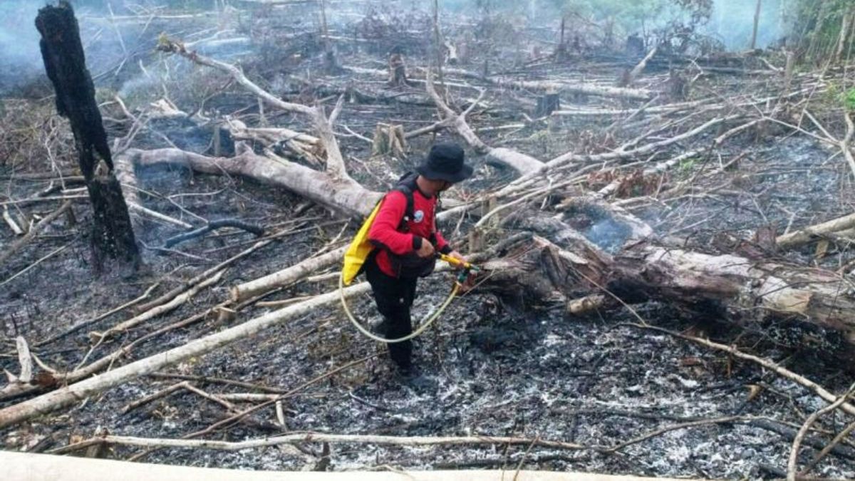


PekanbarU - The Pekanbaru Meteorology, Climatology and Geophysics Agency (BMKG) detected 409 hotspots of forest and land fires (karhutla) in the Sumatra region.
All hotspots were spread over seven provinces in Sumatra, namely in Riau, Bengkulu, Jambi, Lampung, West Sumata, South Sumatra and Bangka Belitung.
Pekanbaru BMKG forecaster M Ibnu A said the highest hotspots were in South Sumatra (Sumsel), Jambi and West Sumatra. "There are 33 points in Bengkulu, 97 points in Jambi, 21 points in Lampung, 98 points in South Sumatra, 89 points in West Sumatra, 37 points in Bangka Belitung, and 34 points in Riau," he said, Sunday, October 27.
He specifically detailed that in Riau, there are five districts that contributed hotspots, namely, Kuantan Singingi Regency with six points, Rokan Hilir with one point, Rokan Hulu with three points, Indragiri Hilir with eight points, and Indragiri Hulu with 16 points.
SEE ALSO:
-
 | BERITA
Pengendara di Jaksel Tewas, Diduga Tertabrak Kereta di Jalur Rel Stasiun Tebet-Cawang
27 Oktober 2024, 08:52 -
 | OLAHRAGA
Modal Pengalaman, Rahmat/Yeremia Bertekad Juara Indonesia International Challenge 2024
27 Oktober 2024, 04:19 -
 | INFO SEHAT
Kapan Anak Harus Lepas Empeng? Simak Penjelasan dan Tips yang Bisa Dilakukan Berikut
27 Oktober 2024, 05:55
Meanwhile, the weather in Pekanbaru City and its surroundings from morning to night is cloudy. Rain with light to moderate intensity is expected to occur in parts of Bengkalis Regency, Meranti Islands, Pelalawan, and Indragiri Hilir.
The visibility in Pekanbaru and its surroundings ranges from 5 to 9 kilometers. Then, the information on airworthiness particulates in Pekanbaru City and its surroundings is relatively good. The graph shows a figure of 30.90 grams/m3 touching the blue line with a moderate category.
The English, Chinese, Japanese, Arabic, and French versions are automatically generated by the AI. So there may still be inaccuracies in translating, please always see Indonesian as our main language. (system supported by DigitalSiber.id)
Most Popular Tags
#Prabowo Subianto #donald trump #2026 World Cup #Febrie Adriansyah #8791Popular


