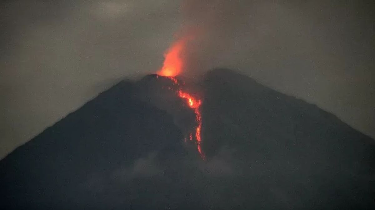


JAKARTA - Mount Semeru in East Java (East Java) erupted several times with an eruption of up to a height of 300 meters above the peak on Wednesday, August 28.
The first eruption occurred at 01.33 WIB with an eruptive column height of about 200 meters above the peak or 3,876 meters above sea level (masllp).
"The ash column was observed to be white to gray with thick intensity to the southwest and west. The eruption was recorded on a seismograph with a maximum amplitude of 22 mm and a duration of 102 seconds," said Mount Semeru Observation Post Officer Ghufron Alwi in a written statement, Wednesday, August 28, which was confiscated by Antara.
Then the second eruption occurred at 02.28 WIB with a column height of ash observed about 300 meters above the peak and the ash column was observed to be white to gray with thick intensity to the southwest and west.
"The eruption was recorded on a seismograph with a maximum amplitude of 22 mm and a duration of 107 seconds," he said.
Furthermore, Mount Semeru erupted again at 03.47 WIB with an eruptive column height of about 200 meters above the peak or 3,876 meters above sea level.
"The ash column was observed to be gray with thick intensity to the west. The eruption was recorded on a seismograph with a maximum amplitude of 22 mm and a duration of 117 seconds," he said.
SEE ALSO:
-
 | BERITA
Daftar Pilkada Jakarta, Pramono Anung: Enggak Perlu Tagline yang Terlalu Hebat
28 Agustus 2024, 12:57


Ghufron explained that the status of Mount Semeru is at Level II or Alert, so that the Center for Volcanology and Geological Hazard Mitigation (PVMBG) provides a number of recommendations, namely that people are prohibited from carrying out any activity in the southeast sector along Besuk Kobokan, as far as 8 kilometers from the summit (the center of the eruption).
Then outside of that distance, people are not allowed to carry out activities at a distance of 500 meters from the riverbank (river border) along Besuk Kobokan, because it has the potential to be affected by the expansion of hot clouds and lava flows up to a distance of 13 km from the summit.
The community is also not allowed to move within a three km radius of the crater/peak of Mount Semeru because it is prone to the danger of throwing stones (pijar).
In addition, it is necessary to be aware of the potential for hot clouds, lava avalanches, and lahars along rivers/valleys that originate at the peak of Mount Semeru, especially along Besuk Kobokan, Besuk Bang, Besuk Kembar, and Besuk Sat, as well as the potential for lahars in small rivers that are tributaries of Besuk Kobokan.
The English, Chinese, Japanese, Arabic, and French versions are automatically generated by the AI. So there may still be inaccuracies in translating, please always see Indonesian as our main language. (system supported by DigitalSiber.id)


