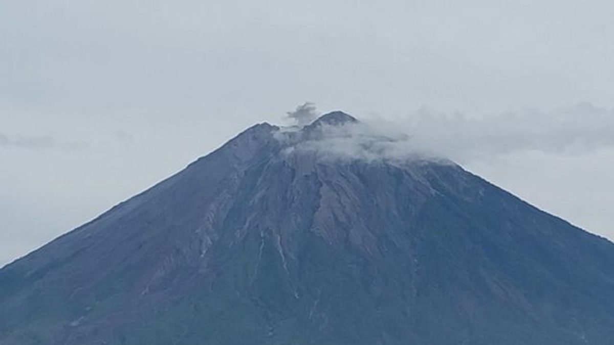


JAKARTA - The activity of Mount Semeru throughout Thursday, July 4, 2024, is still dominated by earthquake eruptions aka eruptions as many as 159 times and will continue until Friday, July 5, 2024.
Mount Semeru has a height of 3,676 meters above sea level (masl) and is in Lumajang Regency, East Java (East Java).
This was conveyed by the officer of the Mount Semeru Observation Post, Mukdas Sofian in a written statement received in Lumajang, Friday, July 5.
"In observations of the seismicity of the period Thursday at 00.00-24.00 WIB, Semeru was recorded to have experienced 159 eruptions/eruption earthquakes with an amplitude of 10-22 mm and a long earthquake of 55-132 seconds," he said.
The mountain, which is on the border of Lumajang Regency with Malang, he said, experienced 12 avalanches with an amplitude of 2-8 mm and an earthquake of 32-78 seconds.
"In addition, 12 earthquake gusts were recorded with an amplitude of 3-8 mm, and an earthquake of 28-74 seconds, then six times a distant tectonic earthquake with an amplitude of 16-40 mm," he said.
Flood vibrational earthquakes were also recorded on Mount Semeru with an amplitude of 10 mm and an earthquake of 2,026 seconds due to heavy rains pouring down the highest mountain peak on the island of Java.
Meanwhile, Head of the Center for Volcanology and Geological Hazard Mitigation (PVMBG) Hendra Gunawan said officers were evaluating the activity of Mount Semeru in stages.
"Based on the results of a thorough analysis and evaluation until June 30, 2024, the activity level of Mount Semeru remains at level III or standby with recommendations that are adjusted to the latest threat of danger," he said.
Hendra said that his party gave recommendations so that people do not carry out any activities in the southeast sector along Besuk Kobokan as far as 13 kilometers from the summit (the center of the eruption).
Then outside of that distance, he said, the community was also advised not to carry out activities at a distance of 500 meters from the river bank (river border) along Besuk Kobokan, because it has the potential to be affected by the expansion of hot clouds and lava flows up to a distance of 17 km from the summit.
SEE ALSO:
-
 | BERITA
Jokowi Sebut Keppres Pemberhentian Hasyim Asy'ri dalam Proses Administrasi
05 Juli 2024, 07:06


Then residents are also prohibited from doing activities within a five-kilometer radius of the crater/peak of Mount Semeru because they are prone to the danger of throwing stones (pijar).
The public is also asked to be aware of the potential for hot clouds, lava avalanches, and lahars, along rivers/valleys that originate at the peak of Mount Semeru. Moreover, along Besuk Kobokan, Besuk Bang, Besuk Kembar, and Besuk Sat, as well as the potential for lahars in small rivers that are tributaries of Besuk Kobokan.
The English, Chinese, Japanese, Arabic, and French versions are automatically generated by the AI. So there may still be inaccuracies in translating, please always see Indonesian as our main language. (system supported by DigitalSiber.id)
Most Popular Tags
#Prabowo Subianto #donald trump #2026 World Cup #Febrie Adriansyah #8791Popular


