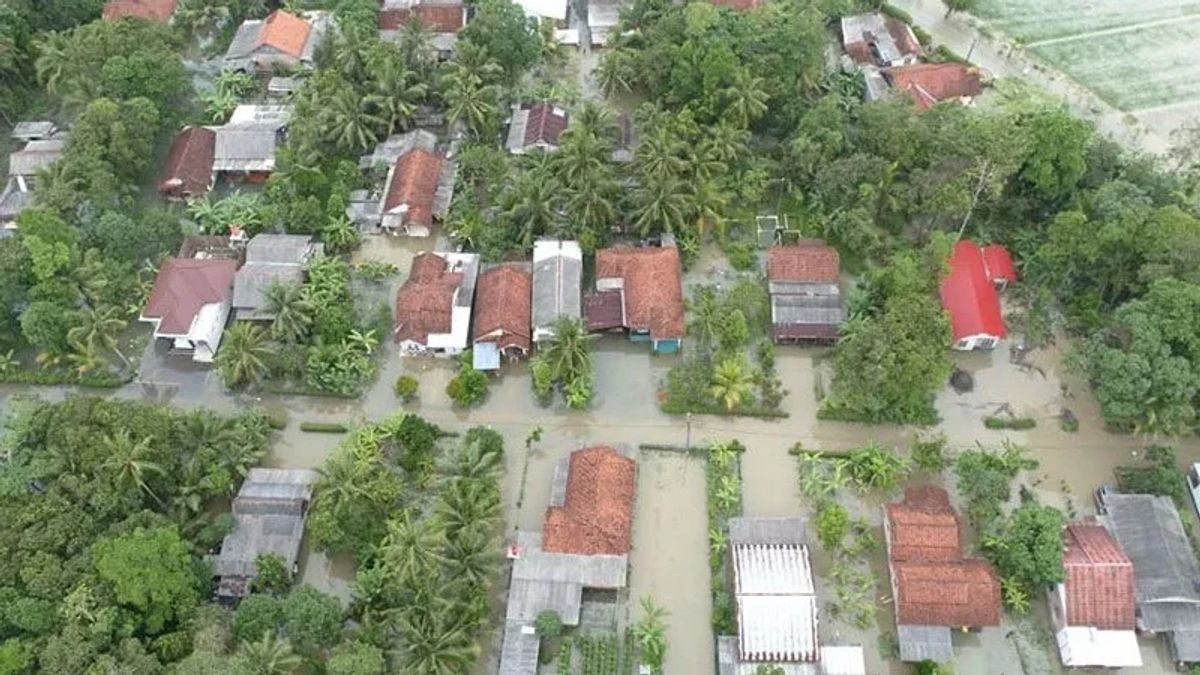


JAKARTA - The Meteorology, Climatology and Geophysics Agency (BMKG) predicts that extreme weather will still have the potential to occur in the southern part of Central Java (Central Java).
Head of the BMKG Technician Group of Meteorological Station Tunggul Wulung Cilacap, Teguh Wardoyo, said that his party appealed to the public to be aware of the potential for hydrometeorological disasters.
"Based on information on the dynamics of the atmosphere on July 4, 2024, until now there are still two factors that have the potential to trigger extreme weather in the southern Central Java region," he said in Cilacap, Thursday, July 4, which was confiscated by Antara.
He said the two factors include Madden Julian Oscillation (MJO) which is in Phase 3 or Indian Ocean, thus contributing to the formation of rain clouds in Indonesian territory.
Apart from MJO, he said, the presence of Equatorial Rossby atmospheric waves in most of Java, Bali, West Nusa Tenggara, East Nusa Tenggara, northern and southern Kalimantan, southern Sulawesi, and Maluku also has the potential to trigger extreme weather in the southern part of Central Java.
SEE ALSO:
-
 | BERITA
Pemilu Inggris 2024: 4.515 Caleg dari 98 Parpol Berebut 650 Kursi Parlemen
04 Juli 2024, 14:19

Furthermore, he said that in general, now it has entered the dry season, but that does not mean that during the dry season there will be no rain.
Under normal conditions, he said, rain still has the potential to occur during the dry season even with light intensity.
"However, with atmospheric dynamics in the form of MJO and Equatorial Rossby waves, extreme weather still has the potential to occur for the next few days," he said.
In this regard, Teguh appealed to the public to remain alert to the possibility of hydrometeorological disasters in the form of floods, landslides, and strong winds in line with the potential for extreme weather in the dry season.
The English, Chinese, Japanese, Arabic, and French versions are automatically generated by the AI. So there may still be inaccuracies in translating, please always see Indonesian as our main language. (system supported by DigitalSiber.id)
Most Popular Tags
#Prabowo Subianto #donald trump #Febrie Adriansyah #8791 #giias 2026Popular


