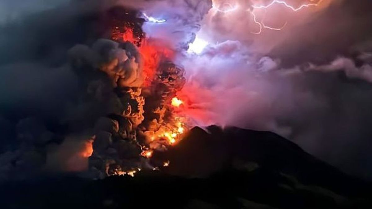


LUMAJANG - Mount Semeru Observation Post Officers in Lumajang Regency, East Java recorded six eruptions of Mount Semeru on Thursday, July 4 in the morning from 00.00 to 06.00 WIB, but there were no visual observations of the eruption because it was covered in fog.
"There was an eruption of Mount Semeru on Thursday, July 4, 2024, at 05.43 WIB. The visuals of the eruption were not observed and when the report was made, the eruption was still ongoing," said Mount Semeru Observation Post Officer Liswanto in a written statement quoted by ANTARA, Thursday, July 4.
The first eruption occurred at 00.12 WIB, then after a few minutes the eruption erupted again at 00.27 WIB, the third eruption occurred at 00.36 WIB, followed by a fourth eruption at 01.04 WIB, then erupted again at 05.12 WIB, then at 05.31 WIB and 05.43 WIB.
The number of eruptions of Mount Semeru from January 1 to July 4, 2024 at 06.00 WIB was recorded 638 eruptions that had been recorded by officers, even the highest number of eruptions compared to several mountains whose status was also on standby in Indonesia in the same period.
Seperti Gunung Lewotobi laki-laki di Nusa Tenggara Timur tercatat 295 kali rupsi, Gunung Marapi di Sumatera Barat tercatat 209 kali rupsi, dan Gunung Ibu di Maluku Utara tercatat 188 kali rupsi.
Meanwhile, the results of the analysis and evaluation of the Center for Volcanology and Geological Hazard Mitigation noted that until June 30, 2024, the activity level of Mount Semeru remained at level III or alert with recommendations that were adjusted to the latest threat of danger.
For this reason, there are several recommendations that the public must comply with, namely not carrying out any activities in the southeast sector along Besuk Kobokan as far as 13 kilometers from the summit (the center of the eruption).
Then outside of that distance, the community is also advised not to carry out activities at a distance of 500 meters from the riverbank (river border) along Besuk Kobokan, because it has the potential to be affected by the expansion of hot clouds and lava flows up to a distance of 17 km from the summit.
SEE ALSO:
-
 | TEKNOLOGI
Google Gemini Akan Bergabung dengan Apple Intelligence Musim Gugur Ini
03 Juli 2024, 10:05


Then residents are also prohibited from doing activities within a five-kilometer radius of the crater/peak of Mount Semeru because they are prone to the danger of throwing stones (pijar).
The public is also asked to be aware of the potential for hot clouds, lava avalanches, and lahars, along rivers/valleys that originate at the peak of Mount Semeru, especially along Besuk Kobokan, Besuk Bang, Besuk Kembar, and Besuk Sat, as well as the potential for lahars in small rivers that are tributaries of Besuk Kobokan.
The English, Chinese, Japanese, Arabic, and French versions are automatically generated by the AI. So there may still be inaccuracies in translating, please always see Indonesian as our main language. (system supported by DigitalSiber.id)
Most Popular Tags
#Prabowo Subianto #donald trump #2026 World Cup #Febrie Adriansyah #8791Popular


