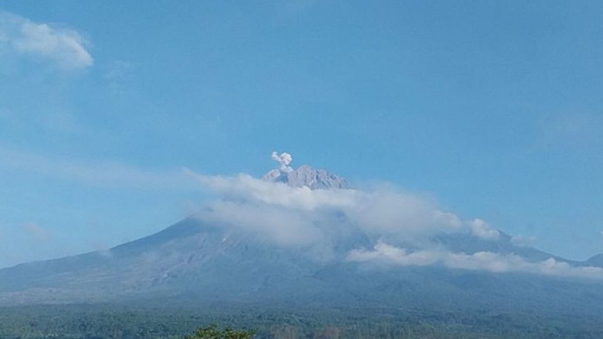


Mount Semeru, which is on the border of Lumajang Regency with Malang, East Java, erupted again with an eruption height of 600 meters above the peak, or about 4,276 meters above sea level (masl) at 07.15 WIB.
"The ash column was observed to be white to gray with thick intensity to the south. The eruption was recorded on a seismograph with a maximum amplitude of 21 mm and a duration of 88 seconds," said Mount Semeru Observation Post Officer Sigit Rian Alfian, as reported by ANTARA, Wednesday, June 26.
The mountain, which has a height of 3,676 meters above sea level, was recorded several eruptions on June 26, which was 00.37 WIB.
Then the second eruption occurred at 03.02 WIB, but the visual eruption was not observed and the eruption was recorded on a seismograph with a maximum amplitude of 22 mm and a duration of 120 seconds.
The eruption occurred again at 09.22 WIB and the eruption visual was not observed, but the eruption was recorded on a seismograph with a maximum amplitude of 22 mm and a duration of 107 seconds.
SEE ALSO:
-
 | BERITA
Sengatan Panas di Washington Bikin Patung Lilin Abraham Lincoln Meleleh
26 Juni 2024, 12:22


Previously, the Head of the Geological Agency of the Ministry of Energy and Mineral Resources (ESDM) Muhammad Wafid in his press release said that hot clouds and incandescent lava avalanches still occurred on Mount Semeru, but visually rarely was observed because they were constrained by the foggy weather.
"Based on the results of the analysis and evaluation, the level of activity of Mount Semeru remains at Level III or Alert with recommendations that are adjusted to the potential for the latest danger," he said in a written statement.
Therefore, his party provides recommendations so that people do not carry out any activities in the southeast sector along Besuk Kobokan as far as 13 kilometers from the summit (the center of the eruption).
The English, Chinese, Japanese, Arabic, and French versions are automatically generated by the AI. So there may still be inaccuracies in translating, please always see Indonesian as our main language. (system supported by DigitalSiber.id)


