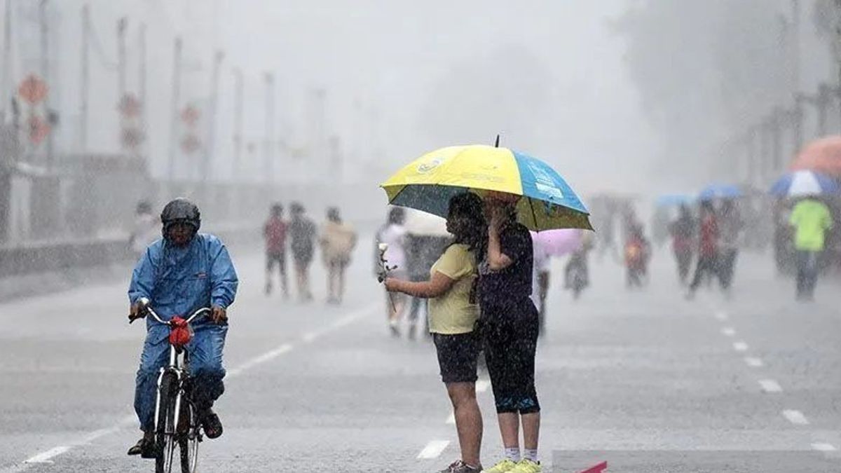


JAKARTA - The Meteorology, Climatology and Geophysics Agency (BMKG) estimates that rain is still pouring down most major cities in Indonesia in line with the circulation of cyclonics, confluences, and convergence in a number of areas.
"This condition is able to increase the potential for rain cloud growth," said BMKG forecaster Nurul Tazaroh in a statement quoted in Jakarta, Sunday, June 9, confiscated by Antara. On the island of Sumatra, BMKG predicts light rain has the potential to fall in Tanjung Pinang, Bandar Lampung, Palembang, and Bengkulu. Meanwhile, heavy rain to thunderstorms are predicted to occur in Medan, Pekanbaru, and Pangkal Pinang. Sunny cloudy weather in Padan, Banda Aceh, and Jambi. On Java Island, light to heavy rain has the potential to occur in Jakarta, Bandung, and Surabaya. Cloudy skies are in Serang, Semarang, and Yogyakarta. Sunda Kecil Islands generally experience light rain, namely Denpasar and Mataram. The city of Kupang is predicted to be cloudy. BMKG forecasts say that Kalimantan Island is cloudy in Palangka Raya and fog in Tanjung Selor. Light rain in Samarinda, then thunderstorms in Pontianak and Banjarmasin. Sulawesi Island is generally cloudy in Mamuju, Makassar, and Kendari. Meanwhile, light rain is predicted to fall in Gorontalo. Then, thunderstorms in Palu and Manado. Then, all eastern regions of Indonesia have the potential to experience light rain, namely Ternate, Manokwari, Jayapura, and Ambon.Nurul said the cyclonic circulation was observed in the Indian Ocean next to western Sumatra which forms a wind speed deceleration area or convergence in Riau. The circulation also forms a wind meeting area or conflucence in the Indian Ocean next to West Sumatra.
In addition, the wind speed deceleration area or convergence was observed extending from the Natuna Sea to the South China Sea, Flores Sea, Tomini Bay, Bone Bay, Band Sea, Seram Sea, Halmahera Sea, Arafuru Sea, and South Papua. "The wind meeting area was observed in the Arafuru Sea and Sulawesi Sea," said Nurul.
SEE ALSO:


He further said that the surface wind generally blows from east to southeast with speeds ranging from 10 to 50 kilometers per hour. Beware of strong winds in East Nusa Tenggara. The air temperature generally ranges from 20 to 34 degrees Celsius with humidity ranging from 50 to 100 percent. The estimated sea wave height ranges from 0.5 to 2.5 meters. Beware of high waves 2.5 to 4 meters in the Indian Ocean west of Lampung and the Indian Ocean south of Java to Bali. "Be aware of tidal flooding on the coast of North Sumatra, the coast of Banten, the coast of Jakarta, the coast of East Java, the coast of East Kalimantan, and the coast of West Kalimantan," concluded Nurul.
The English, Chinese, Japanese, Arabic, and French versions are automatically generated by the AI. So there may still be inaccuracies in translating, please always see Indonesian as our main language. (system supported by DigitalSiber.id)
Most Popular Tags
#Prabowo Subianto #donald trump #2026 World Cup #venezuela #konflik timur tengahPopular


