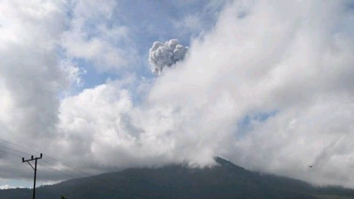


LEWOLEBA- The Geological Agency of the Ministry of Energy and Mineral Resources (ESDM) recorded the eruption of Mount Lewotobi Laki in East Flores, East Nusa Tenggara (NTT), with a height of ash ponds reaching 1,000 meters.
"People affected by the ash rain of Mount Lewotobi Men wear masks or mouth coverings to avoid the danger of volcanic ash in the respiratory system," said Observation of the Lewotobi Fire Post Male Herman Yosef Mboro in a public report received in Lewoleba, the capital of Lembata Regency, Wednesday.
The eruption occurred at 09:15 WITA with a column height of ash being observed at approximately 1,000 meters above the peak or approximately 2,584 meters above sea level.
The eruption was recorded on a seismogram with a maximum amplitude of 47.3 mm and a temporary duration of approximately 6 minutes 12 seconds.
The Geological Agency still maintains the level of activity of the mountain at Level II or Alert.
The Geological Agency also recommended that the community around Mount Lewotobi Male and visitor or tourist do not carry out any activities within a 2 km radius of the Mount Lewotobi Male eruption center.
Recommendations also apply to sectoral 3 km in the North-Northeast and 5 km in the Northeast sector.
Contacted separately, the Head of the Volcano Team from the Center for Volcanology and Geological Hazard Mitigation, Geological Agency, Heruningtyas Desi Purnamasari said that the dominant eruption activity was due to the large supply of magma.
SEE ALSO:


Meanwhile, the sectoral distance towards the Northeast is much longer than other sectors due to the flow of lava.
"Be aware of the pyroclastic flow or hot clouds so that the sector is longer than other radii," said Heruningtyas.
The English, Chinese, Japanese, Arabic, and French versions are automatically generated by the AI. So there may still be inaccuracies in translating, please always see Indonesian as our main language. (system supported by DigitalSiber.id)
Most Popular Tags
#Prabowo Subianto #donald trump #2026 World Cup #Febrie Adriansyah #8791Popular


