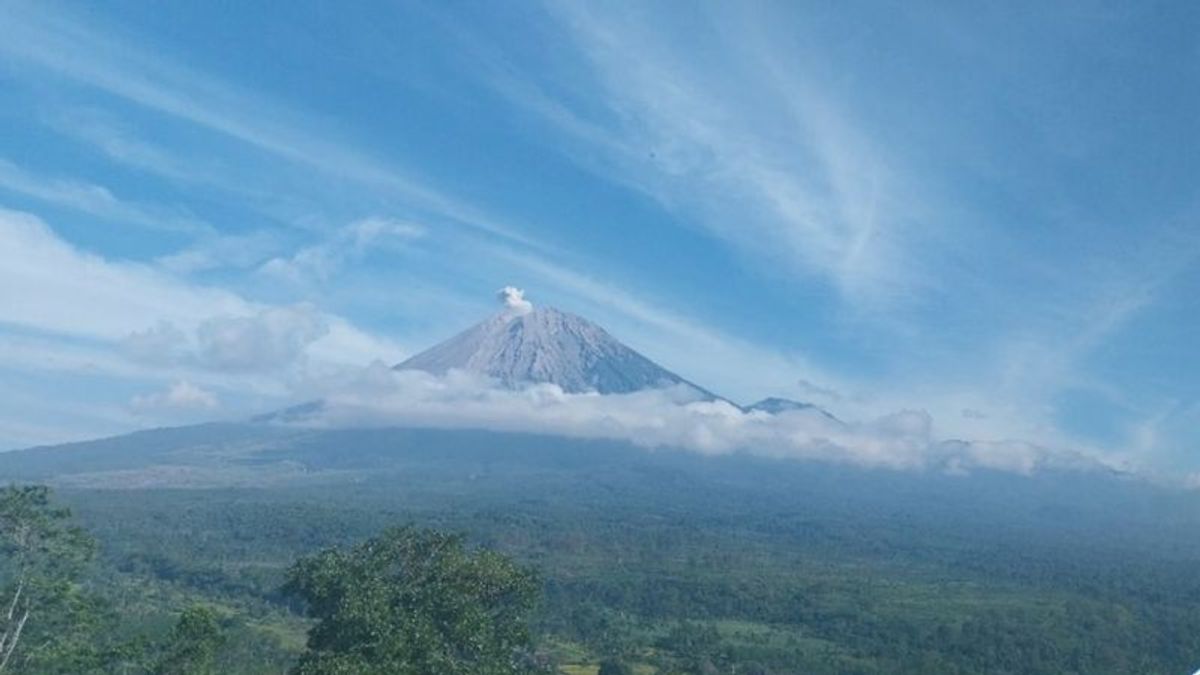


JAKARTA - Mount Semeru in Lumajang Regency, East Java experienced an ongoing eruption eight times on Saturday, June 1, morning to noon. The first eruption of Mount Semeru occurred at 07.39 WIB, then at 07.49 WIB.
The third eruption was recorded at 08.04 WIB, then at 08.20 WIB, then at 09.52 WIB, the next eruption was at 11.34 WIB, the seventh eruption was recorded at 11.50 WIB, and the next eruption was at 13.10 WIB.
"There was an eruption of Mount Semeru on Saturday, June 1, 2024, at 07.39 WIB with a column height of ash observed about 400 meters above the peak or 4,076 meters above the peak," said Mount Semeru Observation Post Officer, Liswanto in a written statement received in Lumajang, Saturday, June 1.
According to him, the volcanic ash column was observed to be white to gray with moderate intensity to the south and when the report was made, the eruption was still ongoing.
Visual eruptions in the first to fourth eruptions were monitored by officers, namely the height of the eruption ranging from 300 meters to 500 meters above the peak, while the fifth to eighth eruptions were visually not observed, because they were covered in fog.
The height of the eighth Semeru eruption column at 13.10 WIB was not observed, but the eruption was recorded on a seismograph with a maximum amplitude of 23 mm and a duration of 97 seconds.
From January 1 to June 1, 2024, at 14.00 WIB, the number of eruptions of Mount Semeru was recorded by officers of the Mount Semeru Observation Post was 343 times.
Quoted from ANTARA, the mountain which has a height of 3,676 meters above sea level (masl) which is the highest mountain on the island of Java is still on Alert or Level III, so the Center for Volcanology and Geological Hazard Mitigation (PVMBG) provides recommendations so that people do not carry out any activities in the southeast sector along Besuk Kobokan as far as 13 kilometers from the summit (the center of the eruption).
SEE ALSO:


Beyond this distance, the community is also advised not to carry out activities at a distance of 500 meters from the riverbank (river border) along Besuk Kobokan, because it has the potential to be affected by the expansion of hot clouds and lava flows up to a distance of 17 km from the summit.
Then, residents are also prohibited from doing activities within a radius of five kilometers from the crater/peak of Mount Semeru, because they are prone to the danger of throwing stones (pijar).
The public is also asked to be aware of the potential for hot clouds, lava avalanches, and lahars along rivers/valleys that originate at the peak of the Semeru Volcano, especially along Besuk Kobokan, Besuk Bang, Besuk Kembar, and Besuk Sat, as well as the potential for lahars in small rivers that are tributaries of Besuk Kobokan.
The English, Chinese, Japanese, Arabic, and French versions are automatically generated by the AI. So there may still be inaccuracies in translating, please always see Indonesian as our main language. (system supported by DigitalSiber.id)
Most Popular Tags
#Prabowo Subianto #donald trump #2026 World Cup #Febrie Adriansyah #8791Popular


