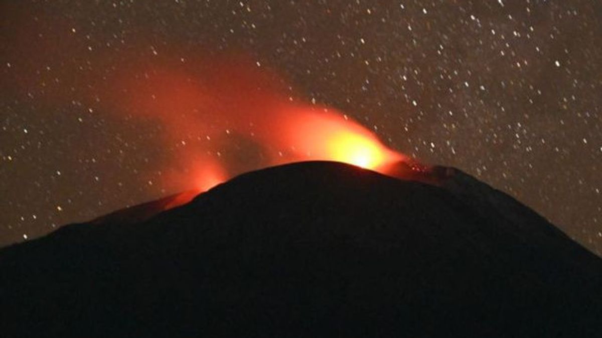


The Geological Agency of the Ministry of Energy and Mineral Resources has expanded the distance or recommended radius of activities around the Ile Lewotolok Volcano in Lembata Regency, East Nusa Tenggara (NTT).
"Based on the latest monitoring data on the instrumental Mount Ile Lewotolok, volcanic activity is still high, so it is recommended to make changes or expand the distance of recommendations, especially in the western sector," said Head of the Geological Agency Muhammad Wafid, quoted by ANTARA, Tuesday, May 14.
The expansion of the recommendation distance in question is the community around Mount Ile Lewotolok as well as visitors, climbers, tourists, and the people of Amakaka Village not to enter and not to carry out activities in the western sectoral area as far as three km from the center of mountain activity.
In addition, the public must be aware of the potential threat of avalanches or lava avalanches from the west of the peak or crater of the mountain.
The Geological Agency issued the recommendation after conducting an evaluation of the results of visual observations.
Based on visual observations, lava flows have been observed flowing to the western sector since May 11, 2024, with a distance of 400 meters from the crater's edge. The lava flow also experienced an expansion of the distance on May 12, 2024, as far as 1,200 meters from the crater's lips.
"The activity level of Mount Ile Lewotolok is still at Level III or Alert," said Muhammad Wafid.
Furthermore, he said that until now the explosive eruption that occurs is often followed by lava avalanches with a range of approximately 500 meters from the eruption center.
The lava flow to the far southeast is still at a distance of approximately 1.8 km and 600 meters to the south and has not experienced a change in distance to date.
The Geological Agency is still recommending the people of Jontona Village and Todonara Village not to enter and not to carry out activities within the southern and southeast sectoral areas as far as 3 km from the center of mountain activity.
The public also needs to be aware of the potential threat of avalanches or lava avalanches from the south and southeast of the peak or crater of Mount Ile Lewotolok.
SEE ALSO:


Furthermore, the Geological Agency also provides recommendations so that people around Mount Ile Lewotolok as well as visitors, climbers, and tourists do not enter and do not carry out activities within a 2 km radius of the mountain activity center.
"And the people of Lamatokan Village and Jontona Village should always be aware of the potential threat of avalanches or lava avalanches from the eastern part of the peak or crater of Mount Ile Lewotolok," he said.
The English, Chinese, Japanese, Arabic, and French versions are automatically generated by the AI. So there may still be inaccuracies in translating, please always see Indonesian as our main language. (system supported by DigitalSiber.id)
Popular


