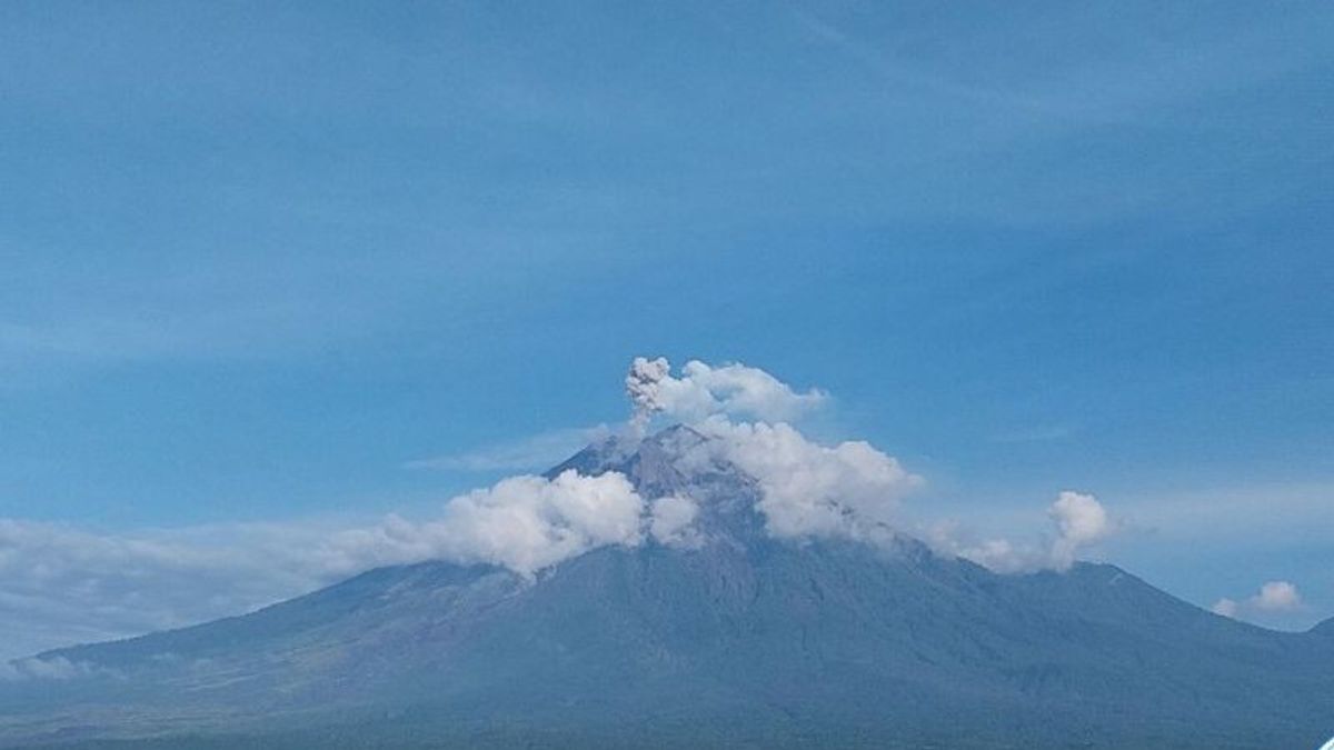


JATIM - Mount Semeru on the border of Lumajang and Malang Regencies, has erupted eight times since Sunday 2 March. The eruption today vomited volcanic ash up to 500 meters from above the peak.
"There was an eruption of Mount Semeru on March 4, 2024 at 06.15 WIB with a height of volcanic ash column observed about 500 meters above the peak or about 4,176 meters above sea level," said Semeru Mountain Observation Post (PPG) Officer Ghfufron Alwi in a written statement, Monday, March 3, confiscated by Antara.
Alwi explained that Mount Semeru erupted five times yesterday at 00.13 WIB, 15.16 WIB, 19.10 WIB, 21.07 WIB, and 11.47 WIB, respectively. Meanwhile, today there have been three eruptions.
The ash column of the eruption of Mount Semeru hri was observed to be white to gray with thick intensity to the southwest and west. The eruption was recorded on the seismograph with a maximum amplitude of 22 mm and a duration of 125 seconds.
The eruption occurred again at 07.18 WIB with a column height of ash observed about 800 meters above the peak or 4,476 meters above sea level.
"The ash column was observed to be white to gray with thick intensity to the west and northwest. The eruption was recorded on a seismograph with a maximum amplitude of 23 mm and a duration of 117 seconds," he said.
After almost five hours, the eruption of Mount Semeru occurred again at 11.49 WIB, but the visual eruption was not observed from the Mount Semeru Observation Post in Sumberwuluh Village, Candipuro District, Lumajang Regency.
"The eruption was recorded on a seismograph with a maximum amplitude of 22 mm and a duration of 118 seconds," he said.
From January 1 to March 4, 2024, at 16.00 WIB, there were 96 times the number of eruptions of Mount Semeru recorded by officers of the Semeru Volcano Observation Post in Lumajang.
Based on data from the Lumajang Regional Disaster Management Agency (BPBD), the eruption that occurred for several weeks in 2024 did not have a significant impact on the activities of residents on the slopes of Mount Semeru.
The status of the mountain, which has a height of 3,676 meters above sea level, is still on alert or level III, so people are prohibited from carrying out any activities in the southeast sector along Besuk Kobokan, as far as 13 km from the summit.
SEE ALSO:
-
 | BERITA
Firli Bahuri Tak Kunjung Ditahan, Kapolri hingga Kajati DKI Digugat Praperadilan
01 Maret 2024, 16:57 -
 | BERITA
Klaim IKN Representasi Indonesia Maju, AHY: Harus Diorkestrasi dengan Baik
01 Maret 2024, 16:15 -
 | BERITA
Cak Imin: Harga Beras Naik Mestinya Petani Untung, Tapi Kenyataan Tidak
01 Maret 2024, 15:19


Beyond this distance, the public is asked not to carry out activities at a distance of 500 meters from the riverbank (river border) along Besuk Kobokan because it has the potential to be affected by the expansion of hot clouds and lava flows up to a distance of 17 km from the summit.
Then the community should not move within a 5 km radius of the crater/peak of Mount Semeru because it is prone to the danger of throwing stones (pijar).
The public is also advised to be aware of the potential for hot clouds, lava avalanches, and lahars along rivers/valleys that originate at the top of Mount Semeru, especially along Besuk Kobokan, Besuk Bang, Besuk Kembar, and Besuk Sat as well as the potential for lahars in small rivers which are tributaries of Besuk Kobokan.
The English, Chinese, Japanese, Arabic, and French versions are automatically generated by the AI. So there may still be inaccuracies in translating, please always see Indonesian as our main language. (system supported by DigitalSiber.id)
Most Popular Tags
#Prabowo Subianto #donald trump #2026 World Cup #Febrie Adriansyah #8791Popular


