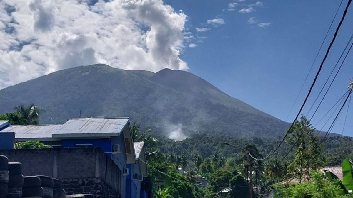


The Center for Volcanology and Geological Hazard Migation (PVMBG) stated that Mount Gamalama Ternate, North Maluku (Malut), emitted smoke and was recorded to have experienced 14 volcanic earthquakes with an amplitude of 4-12 mm.
Head of the Center for Volcanology and Geological Disaster Migation Hendra Gunawan said Mount Gamalama had experienced volcanic earthquakes since last Thursday. Volcanic earthquake shows an increase in pressure within Mount Gamalama due to increased magma activity, but until now surface earthquakes have not been recorded.
Mount Gamalama from Thursday to Friday was recorded 3 times as gusts, 4 times a deep volcanic earthquake, 2 times a local tectonic earthquake, and 5 times a distant tectonic earthquake.
"The activity of crater gusts was observed by thick white crater smoke with a height of 100-400 meters, weak winds to the north," he explained when contacted from Ambon, Antara, Friday, January 23.
PVMBG said that on February 1-2, 2024, 26 earthquakes were recorded, 2 harmonic earthquakes, 1 tornillo earthquake, 1 shallow volcanic earthquake, 34 deep volcanic earthquakes, 57 local tectonic earthquakes, 181 distant tectonic earthquakes, and 2 vibrational earthquakes.
The activity of crater gusts was observed by gusts of thin to moderate white crater smoke with a height of 10-100 meters. Strong weak winds to the north, northeast, east, southeast, south, southwest, and west.
In general, the activity of Mount Gamalama from January 1 to February 23, 2024, tends to fluctuate and is still dominated by deep volcanic earthquakes, local tectonic earthquakes, and distant tectonic earthquakes related to regional tectonic activity around the Haimahera islands.
According to Hendra, the potential danger that most likely occurs is a phreatic eruption with a danger of ejecting material from the main crater hitting the region with a radius of 1.5 km from the center of the eruption. Thin ash rain can occur with distance and intensity depending on the direction and speed of the wind.
Based on the results of observations, analysis of visual and instrumental data, the activity level of Mount Gamalama is still at Level II (Alert).
In connection with the level of activity of Mount Gamalama at Level II (Alert), it is recommended by the community around Mount Gamalama and visitors/tourists not to move within a radius of 1.5 km from the main crater at the top of Mount Gamalama.
SEE ALSO:
-
 | BERITA
Keluhkan Sakit saat Hitung Suara, Ketua KPPS 70 Rawabadak Jakut Meninggal Dunia
15 Februari 2024, 15:35


The English, Chinese, Japanese, Arabic, and French versions are automatically generated by the AI. So there may still be inaccuracies in translating, please always see Indonesian as our main language. (system supported by DigitalSiber.id)
Add VOI as a Preferred Source
Follow VOI news updates across Google.
+
Most Popular Tags
#Prabowo Subianto #donald trump #2026 World Cup #venezuela #konflik timur tengahPopular


13 Juli 2026, 05:46


