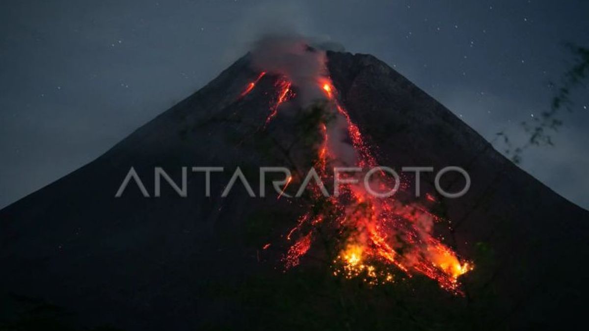
YOGYAKARTA - The Geological Disaster Technology Research and Development Center (BPPTKG) said Mount Merapi on the border of Central Java and the Special Region of Yogyakarta (DIY), this morning launched lava avalanches 10 times towards two rivers in the south and southwest of the mountain.
Head of BPPTKG Yogyakarta Agus Budi Santoso explained, based on observations from 00.00 to 06.00 WIB, lava avalanches with a maximum sliding distance of 1,600 meters (1.6 km) slid towards Bebeng River and Boyong River.
"Eight lava avalanches were observed towards Bebeng River with a maximum sliding distance of 1,600 meters. Two lava avalanches were observed towards Kali Boyong with a maximum sliding distance of 1,500 meters," Agus said in a statement in Yogyakarta, Antara, Wednesday, December 20.
During this observation period, Mount Merapi also experienced 24 avalanche earthquakes with an amplitude of 3-48 mm for 23,84-158.5 seconds, one multi-phase earthquake with an amplitude of 3 mm for 5.6 seconds, and two distant tectonic earthquakes with an amplitude of 3-5 mm for 55.08 seconds.
Based on the morphological analysis of the lava dome from the Deles5 camera station, Tunggullarum, Ngepos, Babadan and analysis of photos of the air at the peak area from the drone survey on December 11, 2023, the morphology of the southwest dome of Merapi was observed due to changes due to hot clouds and lava avalanches.
"For the morphology of the middle dome, it is observed to be relatively fixed," he said.
Based on the analysis of aerial photos, the volume of the southwest dome was measured at 2,592,000 square meters and the middle dome was 2,358,300 square meters.
Until now, BPPTKG still maintains the status of Mount Merapi at Level III or Alert.
The potential danger of lava avalanches and hot clouds from avalanches could have an impact on Woro River up to three kilometers from the summit and Gendol River to five kilometers from the summit.
In addition, lava avalanches and hot clouds of avalanches, he said, could have an impact on Boyong River up to five kilometers from the summit as well as Bedog, Krasak, and Bebeng rivers up to seven kilometers from the summit.
If there is an explosive eruption, he continued, then the ejection of volcanic material from Mount Merapi can reach an area within a radius of three kilometers from the top of the mountain.
SEE ALSO:
The English, Chinese, Japanese, Arabic, and French versions are automatically generated by the AI. So there may still be inaccuracies in translating, please always see Indonesian as our main language. (system supported by DigitalSiber.id)
Most Popular Tags
#Prabowo Subianto #New Year #pdip #Hasto Kristiyanto #nataru #NatalPopular
26 Desember 2024, 01:16
