


JAKARTA - An earthquake with a magnitude of 5.2 that occurred in the southwest of Bengkulu City on Sunday at 07.56 WIB was caused by rock deformation activity.
"By taking into account the location of the epicenter and the depth of the hypocenter, the earthquake that occurred was a shallow type of earthquake due to rock deformation activity in the inter-plate contact area (mgathrust zone)," said Head of the Earthquake Center of the Meteorology, Climatology, Geophysics Agency (BMKG) Daryono, ANTARA, Sunday, October 29.
He said that the epicenter was at sea at a depth of 29 km at coordinates 4.36 South Latitude and 101.99 East Longitude, approximately 69 km southwest of Bengkulu City.
According to him, the earthquake had an upward movement mechanism. "The modeling results show that this earthquake has no potential for a tsunami," he said.
He said that the earthquake was felt in Bengkulu City on the MMI III intensity scale, the vibration felt real inside the house, felt as if a truck had passed.
SEE ALSO:
-
 | BERITA
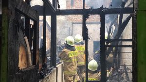
Kebakaran Rumah Warga di Pedati, Sembilan Unit Mobil Damkar Diterjunkan ke Lokasi
15 Oktober 2023, 11:10 -
 | BERITA
Pihak SMPN 132 Cengkareng Berlakukan PJJ 1 Hari Pascaperistiwa Murid Jatuh dari Lantai 4
10 Oktober 2023, 14:40 -
 | BERITA
Rumah di Duren Sawit Terbakar Akibat Tabung Gas 3 Kg Subsidi Pemerintah Bocor
09 Oktober 2023, 09:02


Earthquakes were also felt in the Kepahiang area on the MMI II intensity scale, the vibrations were felt by several people and caused light objects that were hung to sway.
According to the results of BMKG monitoring, Daryono said, until 08.20 WIB there was no aftershock activity after the 5.2 magnitude earthquake that occurred at 07.56 WIB.
The BMKG appealed to residents to avoid buildings that were cracked or damaged by the earthquake and to inspect residential buildings to ensure that no damage could endanger the stability of the building before returning to the house.
The English, Chinese, Japanese, Arabic, and French versions are automatically generated by the AI. So there may still be inaccuracies in translating, please always see Indonesian as our main language. (system supported by DigitalSiber.id)
Most Popular Tags
#Prabowo Subianto #donald trump #2026 World Cup #venezuela #konflik timur tengahPopular


