

JAKARTA - The Meteorology, Climatology and Geophysics Agency (BMKG) reported that an earthquake with a magnitude of 6.6 rocked Tanibar, Maluku.
"Earthquakes in Tanibar were reported to have occurred at around 21.59 WIB," said the Head of the BMKG Earthquake and Tsunami Center, quoted by ANTARA, Friday, September 22.
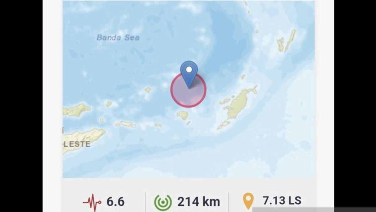
The coordinates of the earthquake were at 7.15 South Latitude (LS) - 129.87 East Longitude (BT) with a depth of 240 kilometers. Meanwhile, the epicenter was 184 kilometers northwest of Tanibar.
He said the earthquake was felt up to Saumlaki, Southeast Maluku Regency.
Types and mechanisms of earthquakes based on the location of the epicenter and the depth of the hypocenter, the earthquake that occurred was an intermediate type of earthquake.
"This earthquake was due to rock deformation in plate slabs that were subducted under the Banda Sea," he said.
SEE ALSO:
-
 | BERITA
KPK Tahan 4 Tersangka di Kasus Korupsi Pembangunan Gereja di Mimika
22 September 2023, 21:01 -
 | BERITA
Video Ajak Warga Coblos Ganjar Langgar Aturan, Gibran: Ya Sudah Saya Ngikutin Aturan Aja
22 September 2023, 20:12 -
 | BERITA
Presiden Jokowi Terima Buku Peta Jalan Indonesia Emas 2045 dari Kadin
22 September 2023, 19:21


BMKG informed that the earthquake had no potential for a tsunami.
"As of 22.25 WIB, the results of BMKG monitoring have not shown any aftershock activity," he said.
Nevertheless, BMKG also appealed to the public to be careful of aftershocks that may occur.
He appealed to the public to remain calm and not be influenced by issues that cannot be justified.
"In order to avoid buildings that are cracked or damaged by the earthquake. Check and make sure the building where you live is earthquake-resistant enough, or there is no damage caused by earthquake vibrations that endanger the stability of the building before you return to the house," he said.
The English, Chinese, Japanese, Arabic, and French versions are automatically generated by the AI. So there may still be inaccuracies in translating, please always see Indonesian as our main language. (system supported by DigitalSiber.id)
Most Popular Tags
#Prabowo Subianto #donald trump #Febrie Adriansyah #8791 #giias 2026Popular


