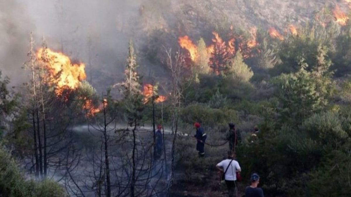


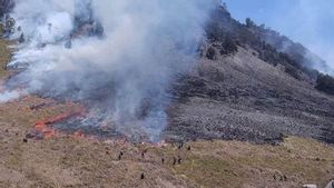
JAMBI - The Jambi Province Forest and Land Emergency Alert Task Force continues to increase preparedness considering that so far more than 500 hectares of land and forest have been burned in the area.
The Head of BPBD Jambi Province, Bachyuni Deliansyah, said that entering the dry season, which was still long, encouraged the Karhutla Task Force team to conduct an evaluation because based on weather forecast data from BMKG, the dry season occurred until the end of September 2023.
"This means that the task force team still needs to prepare for disaster mitigation related to forest and land fires and even though Jambi today is in the category that the hotspots can be extinguished quickly," Bachyuni said as quoted by ANTARA, Monday, September 18.
The Karhutla Task Force team also continues to intensify coordination with all personnel in the field, both from the TNI and Polri to anticipate forest and land fires, including reminding village heads not to be careless.
He said that according to the Jambi Governor's Circular, TNI and Polri personnel were expected to be able to help to anticipate mitigation of forest and land fires prevention.
"As of today, more than 500 hectares of land have been burned and this case is still the smallest category of all over Indonesia. However, we cannot be satisfied and instead we have to work harder on how Jambi is smoke-free," said Bachyuni.
To overcome forest and land fires in Jambi, there are now around 500 drilling wells spread across three districts, the most are in Tanjung Jabung Barat Regency, then in Tanjung Jabung Timur and Muarojambi.
Each of the drilling well locations is divided into Muara Kumpeh and Sungai Gelam sub-districts in Muarojambi Regency, then in Tanjung Jabung Timur Regency, spread across Muara Sabak Barat, Geragai, and Dendang sub-districts. Meanwhile, in Tanjung Jabung Barat District, it is located in Senyerang and Bram Itam Districts.
SEE ALSO:
-
 | BERITA
Karhutla di Pedamaran OKI Sumsel Berhasil Dijinakan dengan Bom Air
18 September 2023, 10:26 -
 | BERITA
Hingga Malam Hari, BPBD Tapin Kalsel Berjibaku Padamkan Api Amankan Permukiman dari Karhutla
15 September 2023, 22:27 -
 | BERITA
BPBD Tapin Berjibaku Padamkan Karhutla Cabai Hiyung yang Siap Panen
15 September 2023, 19:24
According to him, the drill well point is located in a location that has been considered prone to forest and land fires and also the location is included in the indicative map of restoration.
The function of the drill well is as a means of wetting peatlands that are prone to drought and water sources when fires occur in the area.
The English, Chinese, Japanese, Arabic, and French versions are automatically generated by the AI. So there may still be inaccuracies in translating, please always see Indonesian as our main language. (system supported by DigitalSiber.id)
Most Popular Tags
#Prabowo Subianto #donald trump #2026 World Cup #Febrie Adriansyah #8791Popular


