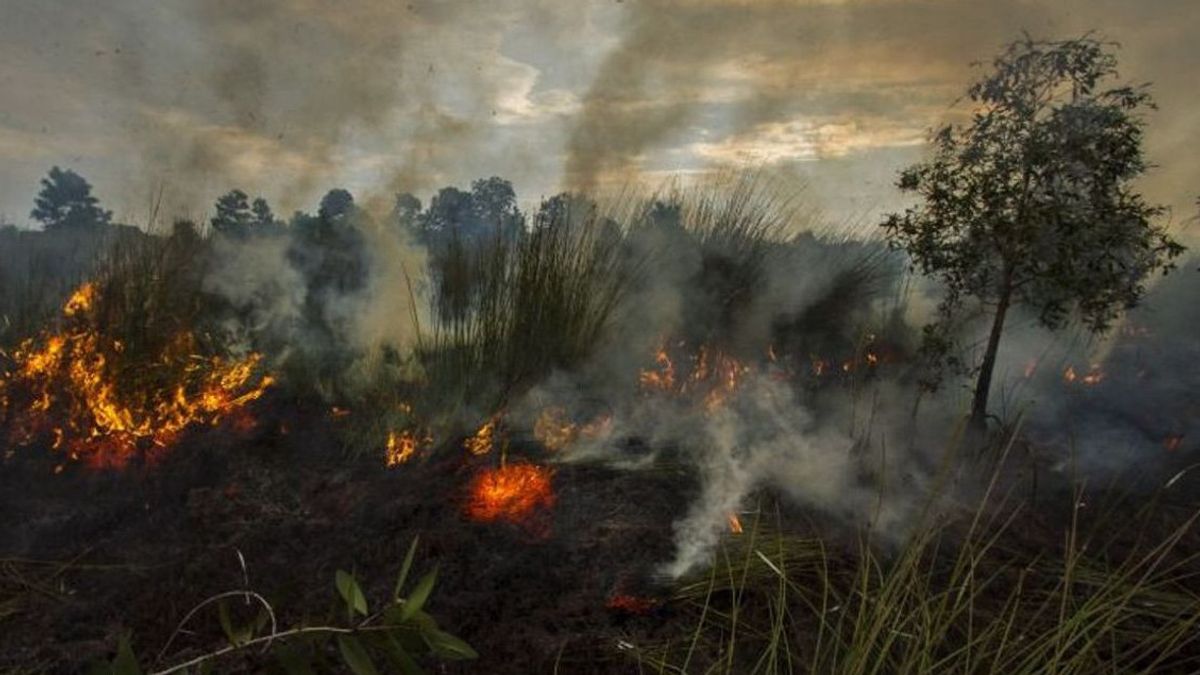
JAKARTA - The Ministry of Environment and Forestry (KLHK) sent 96 warning letters for finding hotspots or hotspots to companies to immediately take precautions and control of forest and land fires (karhutla).
"Since January until now, we have issued 96 warning letters to corporations or concession holders where there are indications of hotspots at their locations," said Director General of Environmental and Forestry Law Enforcement of the Ministry of Environment and Forestry, Ratio Ridho Sani, as reported by ANTARA, Monday, August 14.
Ridho's ratio said that his party continues to monitor hotspots at forest and plantation concessions throughout Indonesia. If there are indications of hotspots above 80 percent, the Ministry of Environment and Forestry (KLHK) sent a warning letter to prevent hotspots from spreading.
According to him, as many as 96 warning letters were mostly addressed to corporations on the islands of Sumatra and Kalimantan, because there are many companies that manage concessions and plantations there.
"If we see any indication of intentional forest and land fires in the locations of the concessions, then we will take firm action," said Ratio Ridho.
The Ministry of Environment and Forestry continues to strengthen criminal and civil law efforts by forming a special team through a memorandum of understanding between the Minister of Environment and Forestry, the National Police Chief, and the Attorney General's Office, to enforce the special integrated law of forest and land fires.
VOIR éGALEMENT:
The Ministry of Environment and Forestry has also held joint coordination meetings with investigators from PPNS as well as police investigators and prosecutors who work in Sumatra and Kalimantan to strengthen law enforcement areas.
"We have mapped the locations (hotspots). If there are criminal indications, of course we will take legal steps," concluded Rasio.
Based on data on the distribution of hot spots caught by various satellites summarized on the Sipongi+ KLHK website, currently there are 124 hotspots with high confidence levels and 892 hotspots with medium confidence levels.
As of June 2023, the Ministry of Environment and Forestry noted that there were 50,570 hectares of forest burned throughout Indonesia. The widest cases of fires were in East Nusa Tenggara (NTT) with a figure of 15,476 hectares, West Nusa Tenggara (NTB) with 5,916 hectares, and West Kalimantan (West Kalimantan) with 5,772 hectares.
The forest and land fires area is calculated based on the analysis of the landsat satellite image of 8 OLI/TIRS which is overlayed with data on the distribution of hotspots as well as reports on the results of hotspot checks and reports of blackouts carried out by Manggala Agni.
The English, Chinese, Japanese, Arabic, and French versions are automatically generated by the AI. So there may still be inaccuracies in translating, please always see Indonesian as our main language. (system supported by DigitalSiber.id)
