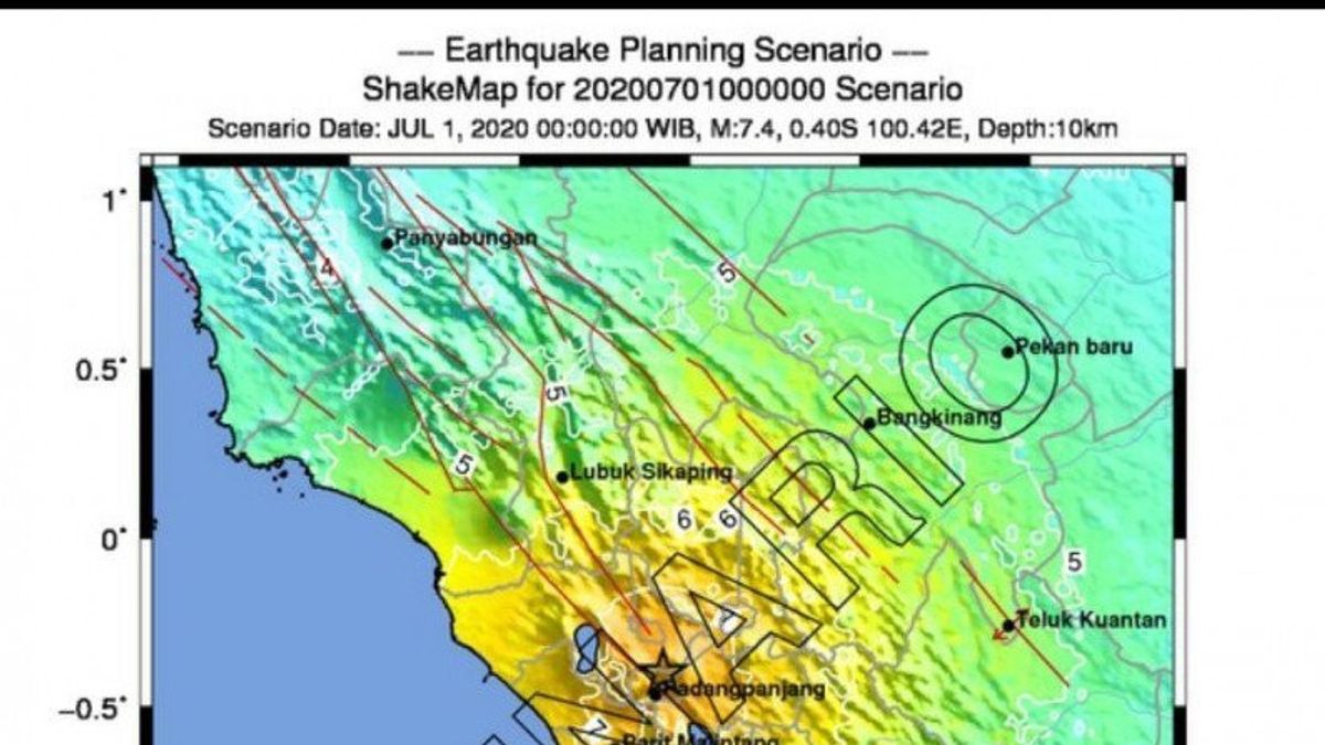


BUKITTINGGI - Head of the Earthquake and Tsunami Center of the Meteorology, Climatology and Geophysics Agency (BMKG) Daryono said the earthquake had a magnitude of 4.5 in the Bukittinggi area, West Sumatra, on Saturday, April 8, had no potential for a tsunami. "Modeling results show that this earthquake has no potential for a tsunami," Daryono said in a statement, in Jakarta, Saturday, quoted by Antara.
#Gempa Mag:4.1, 08-Apr-2023 12:32:11WIB, Lok:0.29LS, 100.32BT (5 km BaratLaut BUKITTINGGI-SUMBAR), Kedlmn:10 Km #BMKG Disclaimer:Informasi ini mengutamakan kecepatan, sehingga hasil pengolahan data belum stabil dan bisa berubah seiring kelengkapan data pic.twitter.com/r3zCCRIv6M
— BMKG (@infoBMKG) April 8, 2023
Daryono explained that the epicenter of the earthquake was located at coordinates 0.30 South Latitude (LS); 100.28 East Longitude (BT), or precisely located on land at a distance of 9 kilometers northwest of Bukittinggi, West Sumatra at a depth of 10 kilometers. His party said that based on the location of the epicenter and the depth of the hypocenter, the earthquake that occurred was a shallow type of earthquake due to active fault activity in the Sianok segment.
SEE ALSO:


The English, Chinese, Japanese, Arabic, and French versions are automatically generated by the AI. So there may still be inaccuracies in translating, please always see Indonesian as our main language. (system supported by DigitalSiber.id)
Most Popular Tags
#Prabowo Subianto #donald trump #Febrie Adriansyah #8791 #giias 2026Popular


