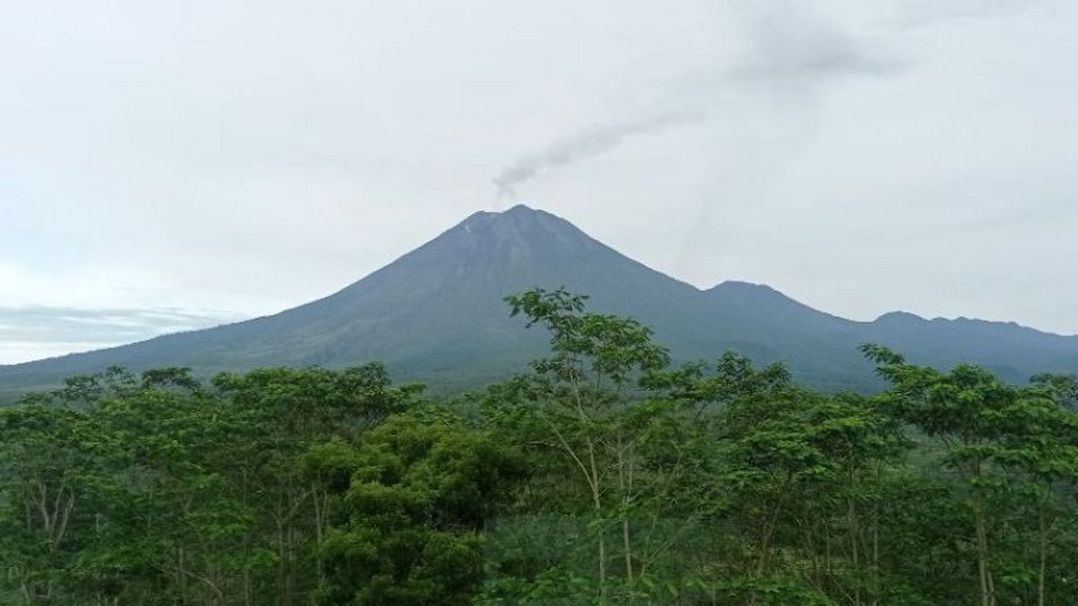


LUMAJANG - The Volcano Monitoring Post (PPGA) stated that the activity of Mount Semeru which has a height of 3676 meters above sea level (masl) in Lumajang Regency, East Java is still dominated by earthquakes or eruptions with the status of the mountain at level III or standby.
Observations of the highest mountain activity on the island of Java on Friday at 00.00-06.00 WIB from the Semeru Volcano Monitoring Post (PPGA) on Mount Sawur, Lumajang Regency visually the volcano was clearly visible, crater smoke was not observed, the weather was sunny, and the wind was weak to the ground. North direction.
"For seismic observations, 22 eruptions or eruptions have been recorded with an amplitude of 18-22 mm, and an earthquake duration of 70-110 seconds", said PPGA officer Semeru Liswanto in a written report received by BPBD Lumajang, reported by ANTARA, Friday, November 25.
In addition, it was recorded that Mount Semeru experienced one gust earthquake with an amplitude of 2 mm and an earthquake duration of 35 seconds, then three deep volcanic earthquakes with an amplitude of 11-34 mm, and two distant tectonic earthquakes with an amplitude of 9-20 mm.
Then the next six hours of observations at 06.00-12.00 WIB still recorded 19 times of earthquake eruptions with an amplitude of 11-22 mm and an earthquake duration of 65-105 seconds.
Liswanto explained that the activity of Mount Semeru on Thursday, November 24 during the observation period at 00.00-24.00 WIB recorded 82 earthquake eruptions with an amplitude of 10-23 mm, and an earthquake duration of 35-139 seconds.
"Mount Semeru also experienced four gusts of earthquakes, one deep volcanic earthquake, three distant tectonic earthquakes, and one flood tremor", he said.
According to him, the status of Mount Semeru is still level III or on alert, so people are advised not to do any activities in the southeast sector along Besuk Kobokan, as far as 13 km from the summit (the center of the eruption).
SEE ALSO:

Beyond this distance, he continued, the community did not carry out activities within 500 meters of the riverbank (river border) along Besuk Kobokan because of the potential for expansion of hot clouds and lava flows to a distance of 17 km from the summit.
"We also urge the public not to move within a 5 km radius from the crater/peak of Mount Semeru because it is prone to the danger of throwing stones (incandescent)", he said.
The public is also asked to be aware of the potential for hot clouds of avalanches (APG), lava avalanches, and lahars along rivers/valleys that originate at the summit of Mount Semeru, especially along Besuk Kobokan, Besuk Bang, Besuk Kembar, and Besuk Sat as well as the potential for lahars in rivers and streams. a small river that is a tributary of Besuk Kobokan, said Liswaanto.
The English, Chinese, Japanese, Arabic, and French versions are automatically generated by the AI. So there may still be inaccuracies in translating, please always see Indonesian as our main language. (system supported by DigitalSiber.id)
Most Popular Tags
#Prabowo Subianto #donald trump #2026 World Cup #bgn #konflik timur tengahPopular


