

TANGERANG - The Regional Disaster Management Agency (BPBD) of Tangerang City recorded 19 flood points that submerged the area. It is known that the height of the flood varies from 30 centimeters to 1.5 meters.
Head of the Emergency and Logistics Division of the Tangerang City BPBD, Ghufron Falfeli, said that if the flood was caused by high rainfall intensity, as well as overflowing water, both in the Cisadane River and Angke River.
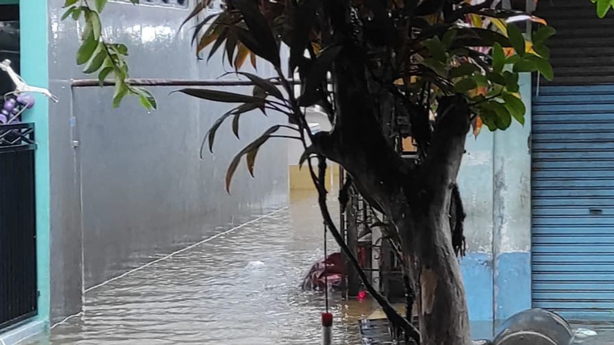
"Currently, the status is on alert because several streams of water have overflowed and submerged people's houses and roads," he said, Saturday, July 16.
In handling it, a joint team consisting of BPBD, PMI, TNI-Polri, Tagana and even the community, worked together to evacuate and monitor residents who still chose to stay in their respective homes.
"We continue to monitor the water level and the condition of residents who still choose to stay in their homes," he said.
His party also established emergency posts at 4 points, including the Al-Irsyad Karang Tengah Mosque, Ciledug 1 or CI 1 Bridge, Pinang Griya Mosque and the Puri Kartika Community Hall.
Meanwhile, the latest data for 19 flood points are as follows:
The following are the 19 most recent flood and inundation points in Tangerang City:
1. Sweet Area 3, Jatiuwung ±30cm (17.00 WIB) gradually recedes
2. Around Magora, Jatake ±40cm (18.00 WIB) gradually recedes
4. Jl. Putri sima raya, Perum ±30cm heavy current (17.00 WIB) gradually recedes
5. Cikokol, ±30cm (18.00 WIB) gradually recedes
6. Jl. Gempol Raya, Kunciran, Areca ± 30cm (18.00 WIB) gradually recedes
7. Cimone Mas Permai 1 ±30cm (18.30 WIB) gradually recedes
8. Jl. Kalinga and Jl. Sriwijaya, Perum 3 ±30cm (19.00 WIB) gradually recedes
9. Jl. Ambassador of Cibodas Park, Sangiang Jaya, 30cm pot (19.40 WIB) is still inundated
10. RT.001/05, North Panunggangan, Pinang ±50cm (20.00 WIB) is vacuumed and gradually recedes
11. Alamanda Bridge, Gebang Raya, Periuk ±30cm (20.00 WIB) gradually receding
12. Perum Garden City, RW. 025, Gebang Raya, Periuk ±50CM (20.00 WIB) gradually receding
13. Gempol T-junction, Jl. Sultan Ageng Tirtayasa, Kunciran, Pinang ± 50cm (21.20 WIB) there are still puddles
14. Fly Over Cibodas Park, Cibodas ±50cm (21.00 WIB) there are still puddles
15. Duren Villa Complex, Pedurenan, Karang Tengah ±40-100cm (00.52 WIB) evacuation process
16. Griya Kencana I Complex, West Sudimara, Ciledug ±40-100cm (01.00 WIB) evacuation process
17. Pinang Griya Indah Complex ±40-100cm (02.00 WIB) evacuation process
18. Jl. Alma'arief Kp. Corner Stall, Lightning, Cipondoh ±40-100cm (02.30 WIB)
19. Kp. Candulan, Lightning, Cipondoh ±50-100cm (04.00 WIB)
The English, Chinese, Japanese, Arabic, and French versions are automatically generated by the AI. So there may still be inaccuracies in translating, please always see Indonesian as our main language. (system supported by DigitalSiber.id)
Most Popular Tags
#Prabowo Subianto #donald trump #2026 World Cup #bgn #konflik timur tengahPopular


