

JAKARTA - The Geological Agency of the Ministry of Energy and Mineral Resources is still setting the alert status for Mount Merapi, which is located in Central Java and Yogyakarta, because the volcanic eruption activity is relatively high.
"Based on the results of visual and instrumental monitoring, we conclude that the volcanic activity of Mount Merapi is set at the Alert level," said Head of the Geological Agency, Eko Budi Lelono, as quoted by Antara, Thursday, March 10.
The level III alert status has been set since November 5, 2020 until today. Mount Merapi now has two lava domes, namely the southwest lava dome and the central lava dome of the crater.
Based on an aerial photo analysis conducted on February 20, 2022, the volume of the southwest lava dome is 1,578,000 cubic meters and the volume of lava in the center of the crater is 3,228,000 cubic meters.
On Wednesday (9/3) night, a series of hot clouds fell on Mount Merapi. Meanwhile, on Thursday morning (10/3), the Geological Agency noted that there were 16 hot avalanches with a maximum sliding distance of five kilometers to the southeast in the Kali Gendol channel.
The hot clouds that fell caused ash rain to several places, especially on the northwest side of Mount Merapi with a maximum distance of 13 kilometers. Merapi's current activity is still high because there are 140 avalanches recorded in one day.
"Internal volcanic activity is also still high, indicated by seismicity and deformation data. Internal seismicity (VTB and MP) occurs more than 100 times per day, while the deformation rate of EDM RB1 is 3.5 mm per day," said Eko.
The Geological Agency recommends local governments and stakeholders around Mount Merapi to carry out various mitigation efforts in dealing with the danger of eruptions.
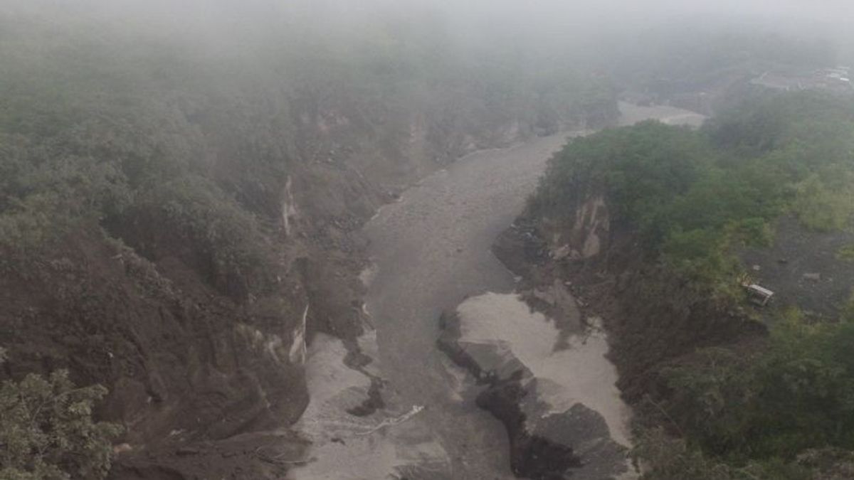
Meanwhile, the community is asked not to carry out activities in potential hazard areas and anticipate disturbances due to volcanic ash from the eruption of Mount Merapi and to be aware of the dangers of lahars, especially when it rains around the volcano.
The current potential danger is in the form of lava avalanches and hot clouds in the south-southwest sector covering the Boyong River for a maximum of five kilometers, the Bedog River, Krasak, Bebeng for a maximum of seven kilometers.
The southeast sector includes the Woro River for a maximum of three kilometers and the Gendol River for five kilometers. Ejection of volcanic material in the event of an explosive eruption can reach a radius of three kilometers from the summit.
The English, Chinese, Japanese, Arabic, and French versions are automatically generated by the AI. So there may still be inaccuracies in translating, please always see Indonesian as our main language. (system supported by DigitalSiber.id)


