

LUMAJANG - The Center for Volcanology and Geological Hazard Mitigation (PVMBG) concluded that based on the results of visual and instrumental monitoring, as well as the potential threat of danger, the activity level of Mount Semeru is still considered to be at level II or alert.
"Visual observations show the appearance of avalanches and hot clouds of avalanches caused by the instability of lava tongue deposits," said the Coordinator of the Volcano Mitigation Group of the Geological Agency for Volcanology and Geological Hazard Mitigation (PVMBG) Kristianto in a written statement quoted by Antara, Saturday, December 4 night.
According to him, the activities that occurred on December 1 and 4 were surface activity (secondary eruptions) and the seismicity did not indicate an increase in the number and type of earthquakes associated with the supply of magma/fresh rock to the surface.
"The number and types of earthquakes recorded during November 1 to 30, 2021 are dominated by surface earthquakes in the form of eruptive earthquakes with an average of 50 events per day," he said.
Avalanche earthquakes on December 1 and 3, 2021, each occurred 4 times. Volcanic earthquakes (deep volcanic earthquakes, shallow volcanic earthquakes and tremors) indicating magma rise to the surface were recorded in very low numbers.
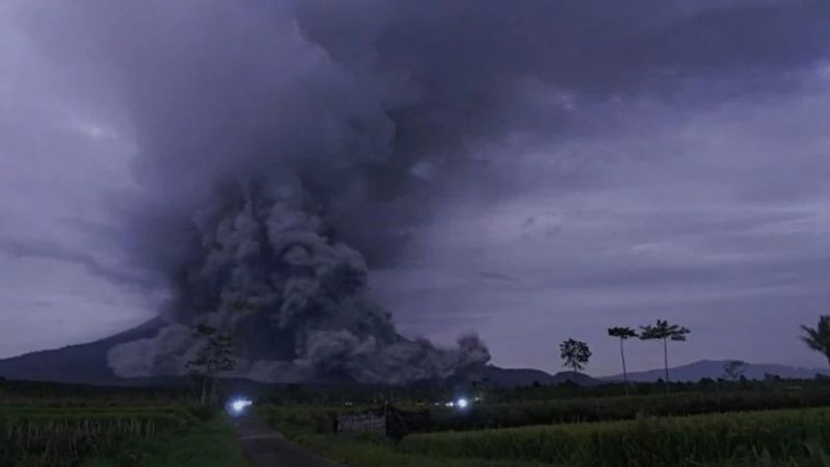
On Saturday, December 4, starting at 13.30 WIB, flood vibrations were recorded, then at 14.50 WIB, hot clouds were observed with a sliding distance of 4 kilometers from the peak or 2 kilometers from the tip of the lava flow to the southeast (Besuk Kobokan). detail glide distance can not be ascertained.
"The potential threat of an eruption of Mount Semeru is in the form of incandescent rock throwing around the peak, while the ash-sized ejected material can be spread further depending on the direction and speed of the wind," he said.
He explained other potential dangers in the form of hot clouds falling and rock falling from the dome/tip of the lava tongue to the southeast and south sectors of the summit.
"If it rains, lahars can occur along the river that originates in the peak area, so that the public is on alert so that people do not move within a 1 kilometer radius of the crater/peak of Mount Semeru and a distance of 5 km towards the south-southeast sector of the crater opening," he said.
In addition, he continued, the public is also asked to be aware of the potential for hot clouds of lava avalanches and cold lava along rivers/valleys that originate at the peak of Mount Semeru, especially in the Besuk Kobokan, Besuk Bang, Besuk Kembar, and Besuk Sat streams.
"The radius and distance of the recommendation will be evaluated continuously to anticipate if there are symptoms of changes in the threat of danger," he said.
The English, Chinese, Japanese, Arabic, and French versions are automatically generated by the AI. So there may still be inaccuracies in translating, please always see Indonesian as our main language. (system supported by DigitalSiber.id)
Most Popular Tags
#Prabowo Subianto #donald trump #2026 World Cup #Febrie Adriansyah #8791Popular


