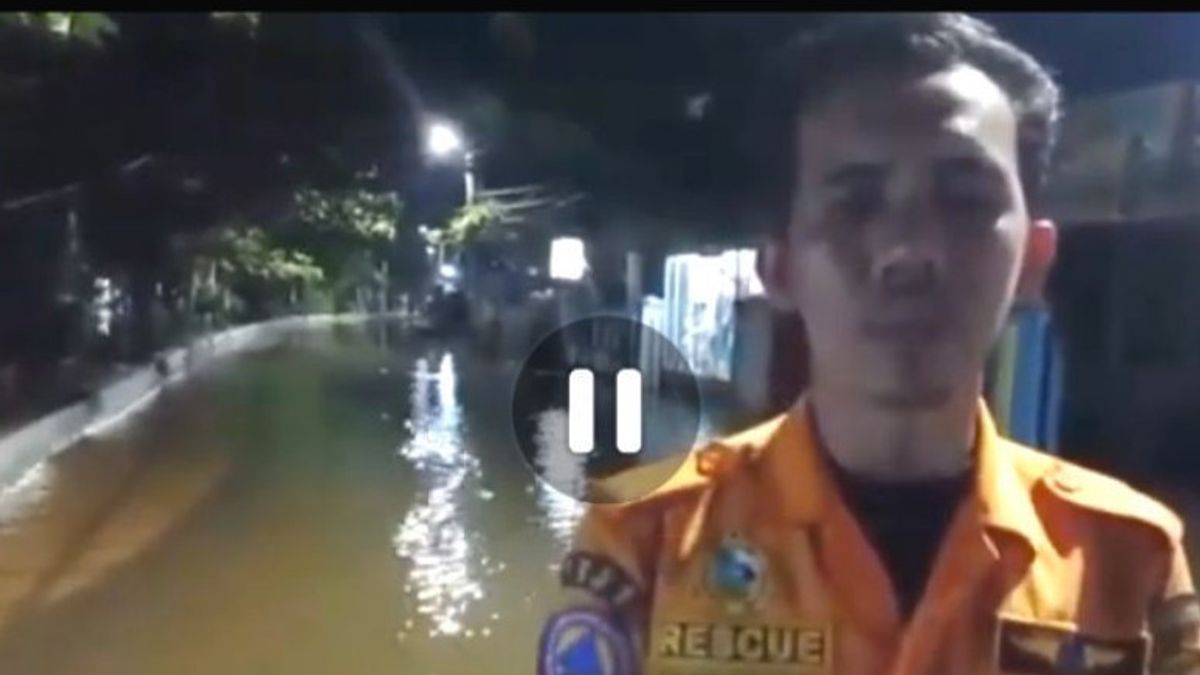


BANJARMASIN - Head of the Regional Disaster Management Agency (BPBD) of Banjarmasin City, South Kalimantan, Fahruraji said that his area had set a disaster alert status because river water had begun to overflow.
"A number of areas began to experience quite high inundation since yesterday (Tuesday, November 9) night," he said in Banjarmasin, as reported by Antara, Wednesday, November 10.
According to Fahruraji, since November 1, 2021, the region has set a flood, landslide, and tidal wave alert status. "Especially we remind this in the area adjacent to the river," he said.
The overflowing river water plus frequent rains with quite high rainfall, said Fahruraji, resulted in some residential areas experiencing inundation of up to 40 centimeters.
"We continue to monitor the intensity of river water levels, as well as prepare for handling if there is an even worse inundation," he said.
Fahruraji said, based on his side's monitoring from Tuesday, November 9 evening until the early hours of the morning, areas affected by river water overflowed or tidal floods caused by La Lina in areas adjacent to river flows.
"The overflowing river water submerged the sub-districts of South Banjarmasin, West Banjarmasin, Central Banjarmasin, and parts of North Banjarmasin," he said.
The details are in West Banjarmasin on Jalan Jafri Zam-zam Keleluran South Belitung with a water level of 20-30 cm, on Jalan Pembangunan Ujung Keluraham Kuin Cerucuk the water level is 40 cm.
SEE ALSO:
-
 | BERITA
Dokumen dari Anak Buah Anies Baswedan Terkait Formula E Akan Ditelaah dan Dikaji KPK
10 November 2021, 08:59


Furthermore, on Jalan Kuin Keluraham Kuin Selatan the water level is 20-30 cm, Jalan Simpang Anem North Belitung Village the water level is 30-40 cm, Jalan Cendrawasih, South Belitung Village the water level is 20-30 cm.
Then on Jalan Sutoyo S, Teluk Dalam Village the water level is 30-40 cm, Jalan Belitung GangTunas Baru, South Belitung Village, the water level is 20-40 cm.
Then in the Central Banjarmasin area on Jalan Rawasari, Citra Sari Complex, Teluk Dalam Village, the water level is 20-30 cm.
For the South Banjarmasin area on Jalan 9 Oktober, Pekauman Village the water level is 20-30 cm high and on Jalan Kelayan B, Kelayan Timur Village, the water level is 20-30 cm.
"Meanwhile, in the District of North Banjarmasin on Jalan Pangeran Kelurahan Pangeran with a water level of 20-30 cm," said Fahruraji.
The English, Chinese, Japanese, Arabic, and French versions are automatically generated by the AI. So there may still be inaccuracies in translating, please always see Indonesian as our main language. (system supported by DigitalSiber.id)


