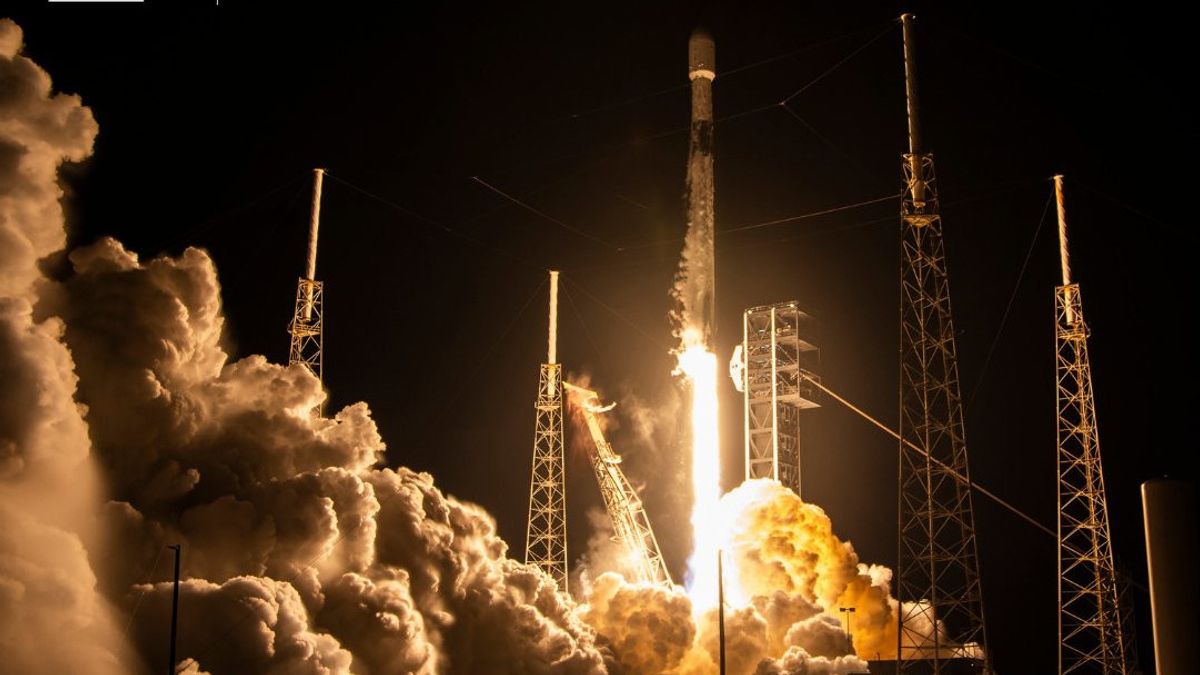


JAKARTA - The United Arab Emirates (UAE) launched a high-tech satellite capable of penetrating darkness and producing high-precision images, to monitor environmental changes to help disaster response.
The leading space technology company UAE launched three advanced satellites to help monitor Earth in real-time, on a mission to step up disaster response efforts and track environmental changes.
The radar satellites "Foresight-3, 4, and 5" are part of a constellation being developed by Abu Dhabi-based Space42. The satellites were launched using SpaceX rockets from Cape Canaveral, Florida, United States earlier this month.
The launch brought Space42 closer to its goal of creating a complete fleet of synthetic apertur radar satellites (SAR) by 2027, with five satellites currently in orbit under company surveillance.
"Space42 plans to expand its leading position globally in this sector, creating a comprehensive constellation of Sar, which is expected to be completed in 2027 to build sovereign satellite data acquisition and processing capabilities," Hasan Al Hosani, chief executive of Bayanat Smart Solutions at Space42, told The National as quoted November 13.
The next chapter begins for Space42’s #EarthObservation capabilities.
Early operations are underway for Foresight-3, Foresight-4, and Foresight-5, expanding the #ForesightConstellation to five satellites.
Images: @SpaceX pic.twitter.com/dGmGflIGoK
— Space42 (@space42ai) November 2, 2025
The next chapter begins for Space42's #EarthObservation capabilities.
Early operations are underway for Insight-3, Insight-4, and Insight-5, explaining the #ForesightConstellation to five satelites.
Images: @SpaceX pic.twitter.com/dGmGflIGoK
This contest uses radar technology that can take high-resolution Earth's surface images under any conditions, day or night, clear skies or storms. This capability helps in monitoring environmental changes, supporting disaster response teams and city planning, as well as observations of Earth in general.
The new satellites were built by Finland's radar imaging company Iceye, then tested and integrated at Space42's assembly, integration and testing plant in Abu Dhabi before being sent to Florida for launch.
Unlike traditional optical satellites that depend on sunlight and sunny weather, radar spacecraft sends radio pulses bouncing off the ground. This allows them to "look" through the clouds and collect images in total darkness.
Each Foresight satellite can capture imagery with a resolution of 25 cm, sharp enough to detect the smallest changes on the ground surface such as soil movement, flooding, or a subtle shift in buildings and roads.
Their data is channeled directly to Space42's AI-based analytic platform, GIQ, which processes images from hundreds of satellites to generate what the company calls "decision-level intelligence".
This system can mark changes almost in real-time, helping governments, infrastructure operators, and industry make faster and more precise decisions.
This technology was used when major floods hit the UAE in 2024 and in Turkey the previous year, when radar imagery confirmed the security of the Ataturk Dam, after a major earthquake while other monitoring systems were offline.
The UAE's first radar satellite, Foresight-1, was launched in 2024, followed by Foresight-2 in January this year.
SEE ALSO:
-
 | BERITA
Indonesia Harapkan Rancangan Resolusi DK PBB Dapat Menjembatani Perdamaian di Palestina
15 November 2025, 16:50 -
 | BERITA
AS Perketat Penerbitan Visa, Pengidap Diabetes hingga Obesitas Terancam Tidak Boleh Masuk
15 November 2025, 12:00 -
 | BERITA
Indonesia Terpilih Sebagai Anggota Dewan Eksekutif IOC dan Komite MOST UNESCO
15 November 2025, 09:00

This latest trio takes the program to its central point, with two more satellites expected to complete the constellation by 2027.
Separately, the Mohammed bin Rashid Space Center in Dubai also operates a 220 kg SAR satellite, called the Etihad-Sat, which was launched into space in March.
SAR technology was developed for military and scientific purposes in the 1950s. NASA's first Sar satellite, Seasat, was launched in 1978.
Currently, demand for SAR is increasing, thanks to advances such as data analysis based on artificial intelligence. Increasing climate challenges also make this technology an important tool for disaster response and environmental monitoring.
The English, Chinese, Japanese, Arabic, and French versions are automatically generated by the AI. So there may still be inaccuracies in translating, please always see Indonesian as our main language. (system supported by DigitalSiber.id)


