

JAKARTA - The European Space Agency's (ESA) latest weather satellite, the Meteosat Third Generation Imager-1 (MTG-I1), has just sent its first Earth view.
The image reveals conditions in Europe, Africa, and the Atlantic in extraordinary detail. Launched on the Ariane 5 rocket on December 13, 2022, MTG-I1 is the first of a new generation of satellites to revolutionize weather forecasts in Europe.
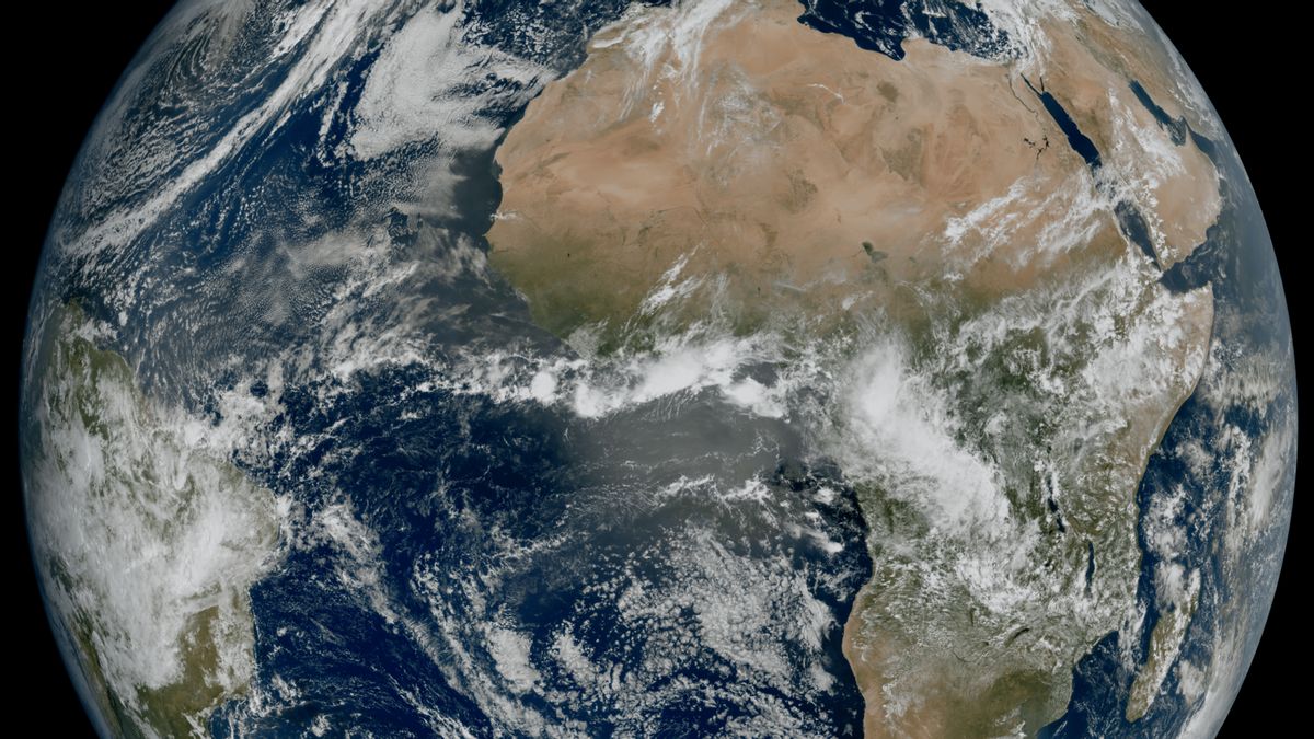
Images captured by the Flexible Combined Imager satellite on March 18, 2023, show most of North and West and Scandinavian Europe shrouded in clouds, with a relatively bright sky above Italy and the Western Balkans.
"This image is a great example of what European cooperation in space can achieve. The level of detail revealed by the MTG-I1 image, which cannot be achieved in Europe and Africa from geostationary orbits until now, will give us a better understanding of our planet and the weather system that formed it," said ESA Earth Observation Program Director Simonetta Cheli in an official statement, quoted Monday, May 8.
"This image not only represents what can be achieved through European expertise but also our determination to ensure the benefits of new technology can be felt by the people in Europe and its surroundings," he added.
اقرأ أيضا:


The instrument aboard the MTG-I1 satellite produces images with a much higher resolution, and more frequent, compared to the Second Generation Meteosat satellite.
Details such as cloud vortices in the Canary Islands, snow cover in the Alps, and sediment in water along the Italian coast can be seen in the image.
However, these details are not clearly visible in the picture of the instruments on the current second-generation spacecraft.
Furthermore, the new image also reveals a greater level of detail than the cloud structure at high latitudes.
This will allow weather forecasts to monitor the evolution of rapidly growing bad weather more accurately in the region.
MTG-I1 is currently undergoing a 12-month commissioning phase, where its instruments, Flexible Combined Imager and Lightning Imager will be enabled and the resulting data calibrated.
Data from satellites will then be disseminated to meteorological services in Europe and its surroundings by the end of 2023, for operational use in weather forecasts.
The soil segment infrastructure needed to process images regularly is used to produce the first image, as a preview of things that will come this year. Images of Earth's disk will be generated every 10 minutes when the system is fully operational.
The English, Chinese, Japanese, Arabic, and French versions are automatically generated by the AI. So there may still be inaccuracies in translating, please always see Indonesian as our main language. (system supported by DigitalSiber.id)