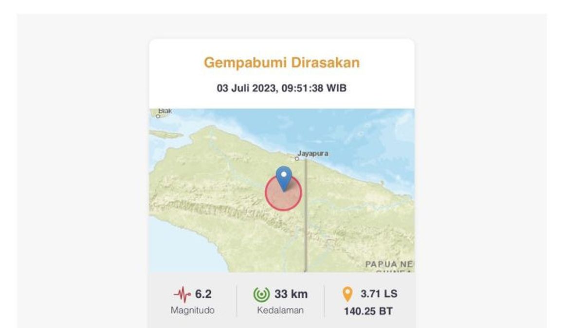


JAKARTA - The Meteorology, Climatology and Geophysics Agency (BMKG) stated that a tectonic earthquake with a magnitude of 6.2 was centered on land, namely 69 kilometers southwest of Keerom, Papua, at 11.51 WIT.
"The epicenter was on land 69 kilometers southwest of Keerom, Papua", wrote BMKG, quoted by ANTARA, Monday, July 3.
In detail, BMKG reported that the 6.2 magnitude earthquake was at coordinates 3.71 degrees Celsius south latitude and 140.25 degrees Celsius east longitude.
The earthquake that occurred at a depth of 33 kilometers was felt with parameters or modifiedmercalliintensity (MMI), namely an earthquake that had an impact and was felt by residents in the Wamena area with a scale of III MMI.
اقرأ أيضا:
-
 | BERITA
Kejagung Periksa Menpora Dito Ariotedjo Jadi Saksi Kasus Korupsi BTS Kominfo
03 Juli 2023, 07:49


This earthquake was also felt in Jayapura with MMI parameters, namely the II-III scale.
"This earthquake is felt to be passed on to the community", he said.
BMKG directs the surrounding community to remain careful of the potential for aftershocks.
"Be careful of possible aftershocks", he said.
The English, Chinese, Japanese, Arabic, and French versions are automatically generated by the AI. So there may still be inaccuracies in translating, please always see Indonesian as our main language. (system supported by DigitalSiber.id)
العلامات الأكثر شيوعًا
#Prabowo Subianto #السنة الجديدة #تحطم الطائرة #هاستو كريستيانتو #ناتارو #squid game 2جمع