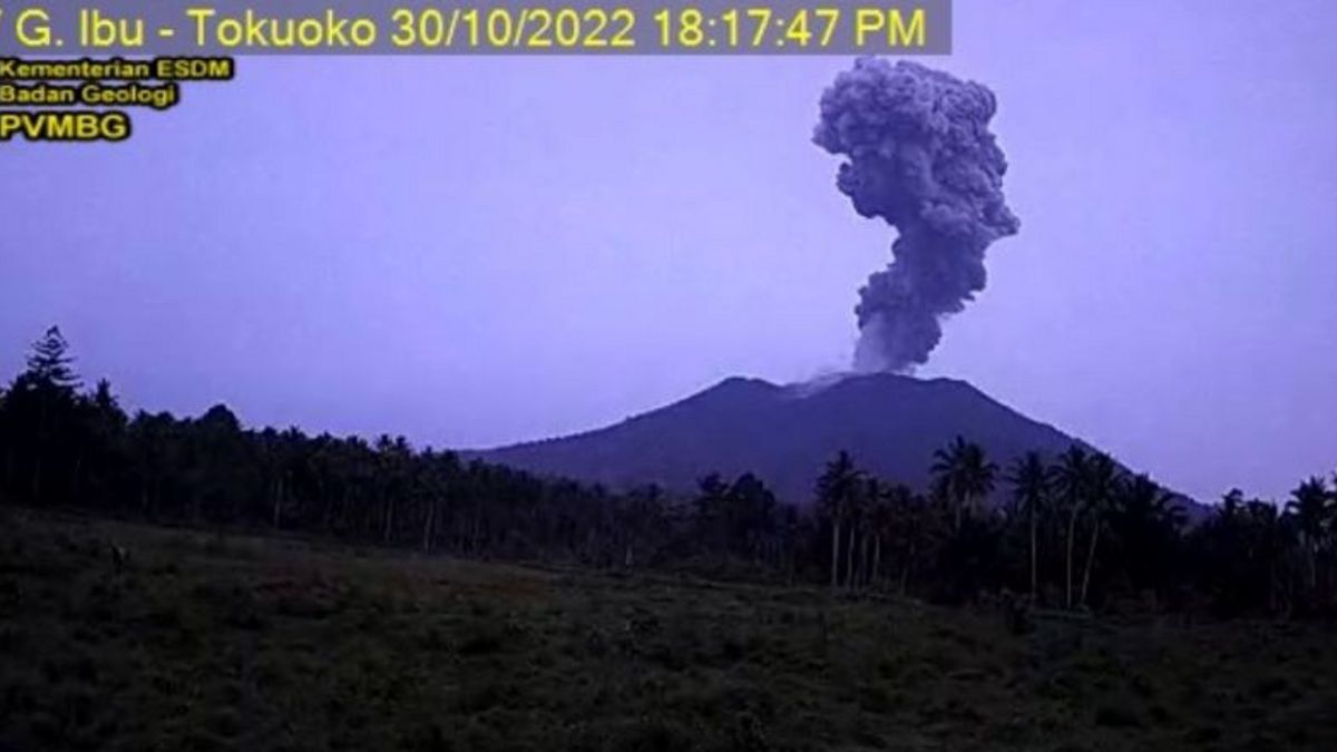


MALUKU - The Center for Volcanology and Geological Hazard Mitigation (PVMB) reported volcanic activity at Mount Ibu, North Maluku, which was marked by a column of ash hurling as high as approximately 2,000 meters or two kilometers above the peak of the volcano.
Mount Ibu Observation Post officer, Axl Roeroe, said the eruption occurred at 18:20 WIT. The ash column is observed to be gray with thick intensity towards the west.
"This eruption was recorded on a seismograph with a maximum amplitude of 30 mm and a duration of 112 seconds," said Roeroe in a statement received in Jakarta, Sunday, October 30.
PVMBG recommends that people and visitors who live or have activities around the mountain should not move within a radius of 2 kilometers and sectoral expansion is 3.5 kilometers towards the crater opening in the northern part of the active crater of Mount Ibu.
If there is ash rain, people who are active outside the home are advised to use nose, mouth (mask), and eye protection (goggles).
관련 항목:
-
 | BERITA
KBRI Seoul: Tak Ada WNI Jadi Korban dalam Festival Halloween Maut di Itaewon
30 Oktober 2022, 09:20 -
 | BERITA
149 Orang Tewas dan Puluhan Luka-luka saat Perayaan Halloween di Seoul
30 Oktober 2022, 05:48


Mount Ibu which has a height of approximately 3,325 meters above sea level is currently still at level II or alert status as of December 10, 2013.
Volcanic activity in the form of eruptions was first recorded in August to September 1911. Then, subsequent eruptions took place in 1998 to 1999 which produced lava plugs.
The next volcanic activity occurred in 2001 to 2004. Then, it continued again in 2019 until now.
Mount Ibu is a stratovolcano type volcano located in the northwest of Halmahera Island, North Maluku, Indonesia.
The top of the mountain is a volcanic crater. The center of the crater is one kilometer wide and 400 meters deep, while the outer part is 1.2 kilometers wide.
The English, Chinese, Japanese, Arabic, and French versions are automatically generated by the AI. So there may still be inaccuracies in translating, please always see Indonesian as our main language. (system supported by DigitalSiber.id)