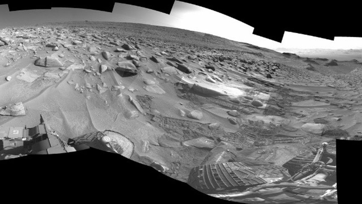
JAKARTA - Marking 11 years of Curiosity belonging to the American Aeronautics and Space Agency (NASA) on Mars, the rover is currently investigating the location dubbed Jau.
Jau is a stop on Curiosity's way to the foot of Mount Sharp on the Red Planet, which has dozens of impact craters.
Mount Sharp itself is a 5 kilometer high mountain covered by lakes and rivers billions of years ago.
Each mountain layer is formed in a different ancient Martian climate era, and the higher Curiosity, the more scientists learn about how the planet's landscape changes over time.
The mountain climbing road over the past few months requires the most difficult climb that Curiosity has ever done.
The rover must bulldoze steeper inclines and more risky terrain. Even so, Curiosity is still safe against the three challenges posed by this slope.
The limp has a sharp incline of 23 degrees, slippery sand, and a rock that is the size of the rover. But, he managed to get through it.
"If you've tried climbing a mound on the beach and that's basically what we're doing. You know it's difficult, but there's also a big rock there," said a Curiosity rover at NASA Jet Laboratory Propulsion (JPL), Amy Hale in a statement, quoted Monday, August 7th.
It is known, Curiosity is indeed far on Mars but it is controlled by a mission team on Earth, including by Hale. They did not operate the rover in real time, instructions were sent to Mars the night before, and data returned to Earth only after the robot completed its work.
The mission team is working with scientists to find out where to direct Curiosity, what images to take, and which targets to be studied using instruments on robotic arms as high as 2 meters.
However, the mission team is also always alert to danger. They must write orders to avoid pointed stones and minimize damage to the Curiosity wheel.
Luckily, Curiosity was never in danger while climbing to Jau. On its way, the rover found itself in both scenarios on several occasions.
"We basically play hope for mistakes. Every day when we enter, we find that we are guilty for one reason or another," said Curiosity's strategic route planning leader at JPL, Dane Schoelen.
Instead of continuing to struggle with the original path, Schoelen and his colleagues made the road turn to the side, eyeing a place roughly 150 meters away where the incline was not too steep.
Schoelen's planner relies on imagery from NASA's Mars Reconnaissance Orbiter to get a rough picture of the terrain, but images taken from space cannot show exactly how steep the slopes are or whether there is a large rock there.
VOIR éGALEMENT:
The turning road will add several weeks of travel to Jau, unless the terrain hides more surprises. If so, the turning road may be in vain, and the mission team must continue to search for other routes to the top of Mount Sharp.
"It feels amazing to finally get through the back of the hill and see that amazing sight," said Schoelen.
I can see pictures of Mars all day, so I can really feel the landscape. I often feel like I'm standing right next to Curiosity, looking back at how far he's been climbing."
Since the difficult climb, the mission team and Curiosity scientists have completed an investigation into the Jau crater cluster.
The cluster is very common on Mars and can form when a meteor breaks in the planet's atmosphere or when fragments are thrown by the impact of a large and further meteoroid.
Scientists want to understand how relatively soft rocks in salt-enriched terrain affect the way craters form and change over time.
Despite all that, Curiosity will soon depart again to explore new, higher areas on Mount Sharp.
The English, Chinese, Japanese, Arabic, and French versions are automatically generated by the AI. So there may still be inaccuracies in translating, please always see Indonesian as our main language. (system supported by DigitalSiber.id)


