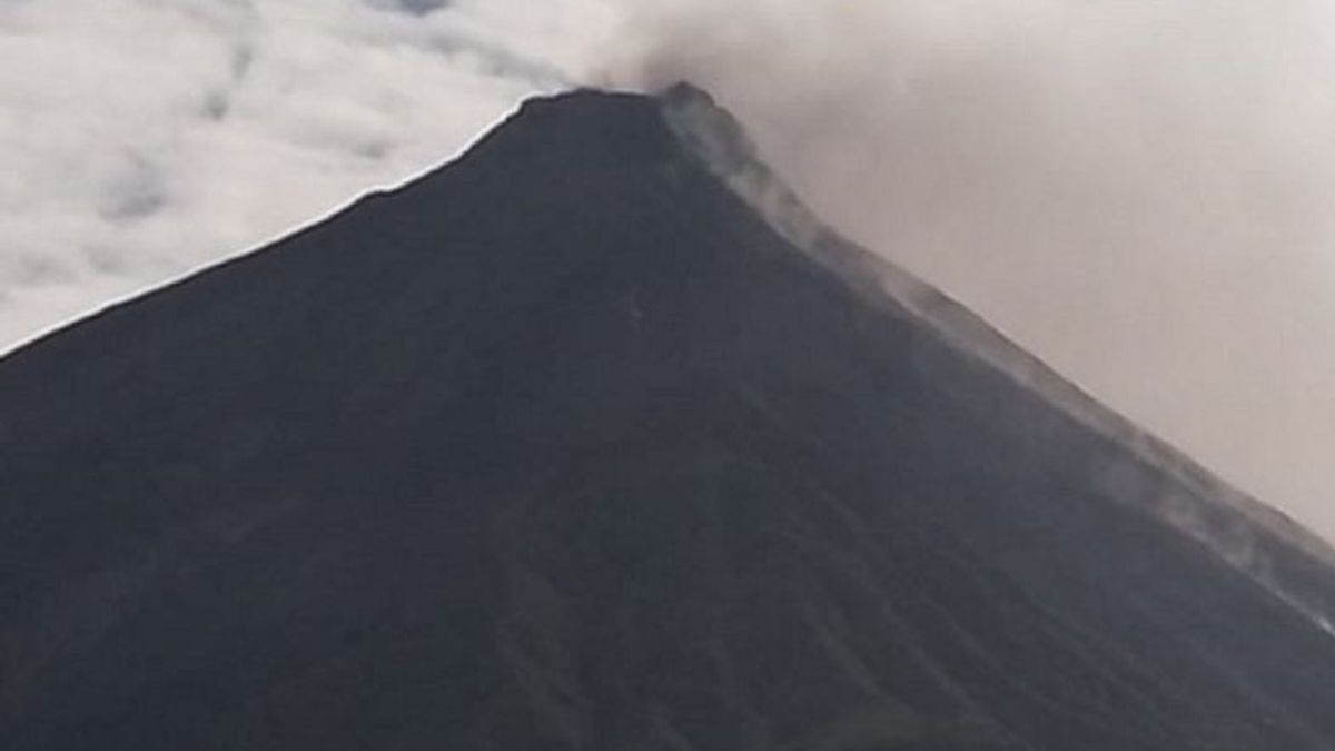


MANADO - Head of the Karangetang Volcano Observation Post (PGA), Yudia P Tatipang, said the mountain lava fell to Batuawang River and Kahetang River with a sliding distance of 1,000-1,500 meters.
"During the observation period from 06.00 WITA to 12.00 WITA, one lava avalanche was observed which led to the two rivers," said Yudia as quoted by ANTARA, Friday, September 1.
During the observation period, Mount Karangetang was clearly visible until it was covered in fog, while pressure crater smoke was being observed to be white with moderate intensity and 50 meters high above the crater peak.
One earthquake was recorded with an amplitude of 25 millimeters for 112 seconds, as well as two earthquake gusts of amplitude between 10-20 millimeters of duration for 16 seconds.
"Tremor continuous or microtremor recorded with an amplitude of between 0.5 millimeters to one millimeter, dominantly 0.5 millimeters," he said.
He added that during the observation period from 00.00 WITA to 06.00 WITA, three earthquakes were recorded: 8-10 millimeters, 35-50 seconds of duration.
While earthquake gusts were recorded six times, the amplitude is between six millimeters to 15 millimeters with a duration of between 10-15 seconds.
VOIR éGALEMENT:
-
 | BERITA
SBY Ungkap Tawaran Koalisi Baru: Ada Menteri Melobi, Sudah Sepengetahuan Pak Lurah
01 September 2023, 21:30 -
 | BERITA
Hormati Keputusan PKB Gabung NasDem Usung Duet Anies-Cak Imin, Gerindra: Selamat Berjuang
01 September 2023, 20:07

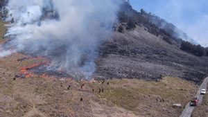

He hopes that residents comply with the hazard radius recommended by the Center for Volcanology and Geological Hazard Mitigation (PVMBG), the Geological Agency of the Ministry of Energy and Mineral Resources (ESDM).
"Be aware of the potential danger of hot clouds falling due to unstable lava piling up at the top or mountain bodies as well as floods of volcanic material during the rainy season from a number of rivers that originate at the top of the crater," he said.
Until now, he said, the level of activity of Mount Karangetang was on alert level three.
The English, Chinese, Japanese, Arabic, and French versions are automatically generated by the AI. So there may still be inaccuracies in translating, please always see Indonesian as our main language. (system supported by DigitalSiber.id)
Tags les plus populaires
#Prabowo Subianto #NCP #Palestine #tangerang sea fence #efesiensi anggaran #iims 2025Populaire