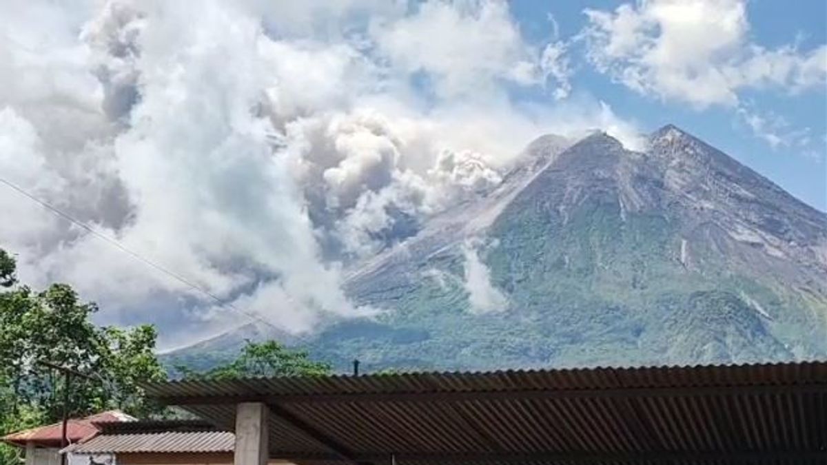
JAKARTA - The Geological Disaster Technology Research and Development Center (BPPTKG) said that hot clouds of avalanches that left Mount Merapi on Saturday, March 11 had a sliding distance of 4 kilometers to the southwest, namely in the Bebeng and Krasak River lanes. Head of BPPTKG Agus Budi Santoso during a virtual press conference monitored in Yogyakarta, Saturday, said based on observations from the first slide at 12.12 WIB to 16.00 WIB, hot clouds of avalanches were recorded outside from Merapi 24 times. "At least the second largest intensity after (eruploading) on January 27, 2021. At that time the series of hot clouds was 52 times towards Kali Boyong," Agus said, quoted by Antara. According to him, the hot cloud avalanche was recorded on a seismograph with an amplitude of 25-70 mm and a duration of 128-458 seconds. August said that light ash rain due to the eruption of Merapi was reported to have occurred in the northwest-north sector with varying intensity, which among them reached Magelang City, Central Java. The ash distribution was also reported to reach the Wonosobo region, Central Java or reached 33 km from the peak of Merapi.
"The length of the distribution of Merapi ash does not mean that the eruption is very large because it depends on the strength of the wind, but the current intensity is quite large," he said. Until now, Budi said the BPPTKG still maintains the status of Mount Merapi on the border of Central Java and the Special Region of Yogyakarta at Level III or Alert.
The lava fall and hot clouds from Mount Merapi can have an impact on areas in the south-southwest sector which include the Boyong River (a maximum of five km) and the Bedog River, Krasak, Bebeng (a maximum of seven km). In addition, lava avalanches and hot clouds from Mount Merapi can impact areas in the southeast sector covering the Woro River (a maximum of three km) and the Gendol River (a distance of five km). If the volcano experiences explosive eruptions, Agus said, the eruption of volcanic material can reach an area within a radius of three kilometers from the top of the mountain.
The English, Chinese, Japanese, Arabic, and French versions are automatically generated by the AI. So there may still be inaccuracies in translating, please always see Indonesian as our main language. (system supported by DigitalSiber.id)


