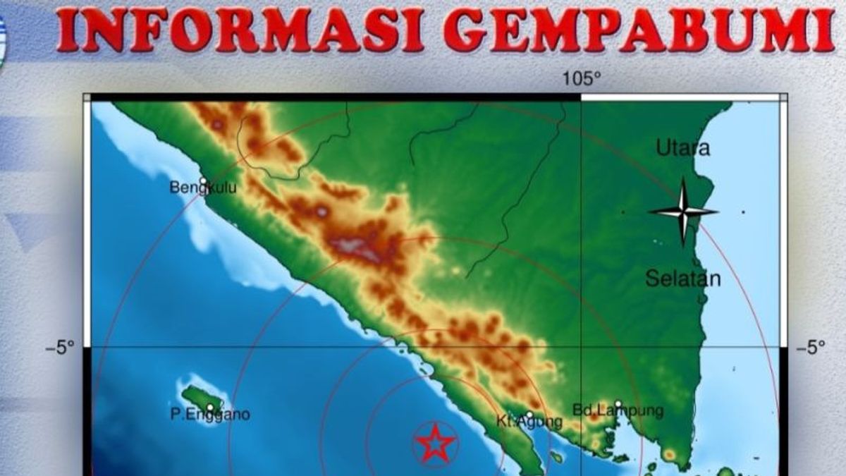
An earthquake with a magnitude of 4.7 rocked the West Coast Regency, Lampung, on Thursday at around 19.19 WIB.
"The earthquake with a magnitude of 4.7 with the epicenter was in the sea 57 kilometers southeast of the West Coast," as reported by the official BMKG website, Antara.
Head of the Pesbar Regional Disaster Management Agency (BPBD), Mirza Sahri, said, based on information from the BMKG, the earthquake occurred at 19.19 WIB.
"Until now, the results of BMKG monitoring have not shown any aftershock activity," Mirza said in Krui.
Furthermore, he said, even though the earthquake was in the sea 57 km southeast, the earthquake felt quite strong, but until now there have been no reports of damage in the West Coast area.
He appealed to the entire community to remain vigilant and not to panic.
"We appeal to all people in the area in West Coast Regency to remain calm," he said.
One resident in Krui, West Coast, Sukri said, he felt strong earthquake vibrations.
"Yes, we were lying down while waiting for the prayer time, I felt the tremors of the earthquake, finally I left the house with my wife's child," said Sukri.
The impact of the earthquake was described by the BMKG shock level (Shakemap) map and based on reports from the public, this earthquake was felt in the West Coast area, with the MMI Intensity II Scale (Shakemap felt by several people, light objects that were hung swayed) However, until now there have been no reports of damage to buildings as a result of the earthquake.
The results of the BMKG analysis show that this earthquake has a magnitude of 4.7 SR centered on coordinates 5.71 South Latitude and 103.94 East Longitude, or precisely located in the sea at a distance of 57 km southeast of the West Coast at a depth of 34 km.
The English, Chinese, Japanese, Arabic, and French versions are automatically generated by the AI. So there may still be inaccuracies in translating, please always see Indonesian as our main language. (system supported by DigitalSiber.id)
Tags les plus populaires
#Prabowo Subianto #Golkar #OTT KPK #élections jakarta #jeux d’argent en lignePopulaire
29 November 2024, 01:05
29 November 2024, 01:09
29 November 2024, 01:27
