

JAKARTA - High rainfall often causes flooding or standing water for a long duration. Especially for those of you who live around Jabodetabek and big cities that are at risk of flooding.
Now there are a number of flood monitoring applications, which can be accessed easily via the internet. These applications will be very helpful in showing which areas are affected by flooding and alternative traffic routes in an area.
Following VOI, we have summarized some of the applications that will be useful when flooding occurs around you. Some of them even have features of monitoring the water level or flood inundation, as well as a safety location.
1. Monitor Floods
The Flood Monitoring application was developed by the Provincial Government (Pemprov) of DKI Jakarta. As the name suggests, the Flood Monitoring application has a number of features that allow users to monitor flood conditions around the Jabodetabek area.
Through this platform, users can share information and find out how severe the flood was in a certain location through photo reports. Furthermore, there is information on the sluice gate, the area of the observation post, the location and number of water pumps that can operate. It is known, this application has been downloaded 50 thousand times on the Play Store.

2. DKI Jakarta Province Flood Early Warning System
This platform was developed by the DKI Jakarta Water Resources Agency which features an alert status, a map of the location of the Automatic Water Lavel Recorder (AWLR) station, weather forecasts, public reports and photos of Water Level Monitoring (TMA) activities.
This application also features CCTV monitoring, important contacts for related agencies, as well as suggestions and input. Not only that, users can also get notifications regarding the alert status of several floodgates in the Jakarta area with details of the time and volume of water.
3. Google Maps
Not only does it function as navigation, the Google Maps application also has a flood feature, where users can find locations and report information on road closures due to flooding.
This flood feature will show a map display showing the location of floods and road closures. In addition, users can also access the latest information through the latest info feature which will automatically enter the Google Search page.
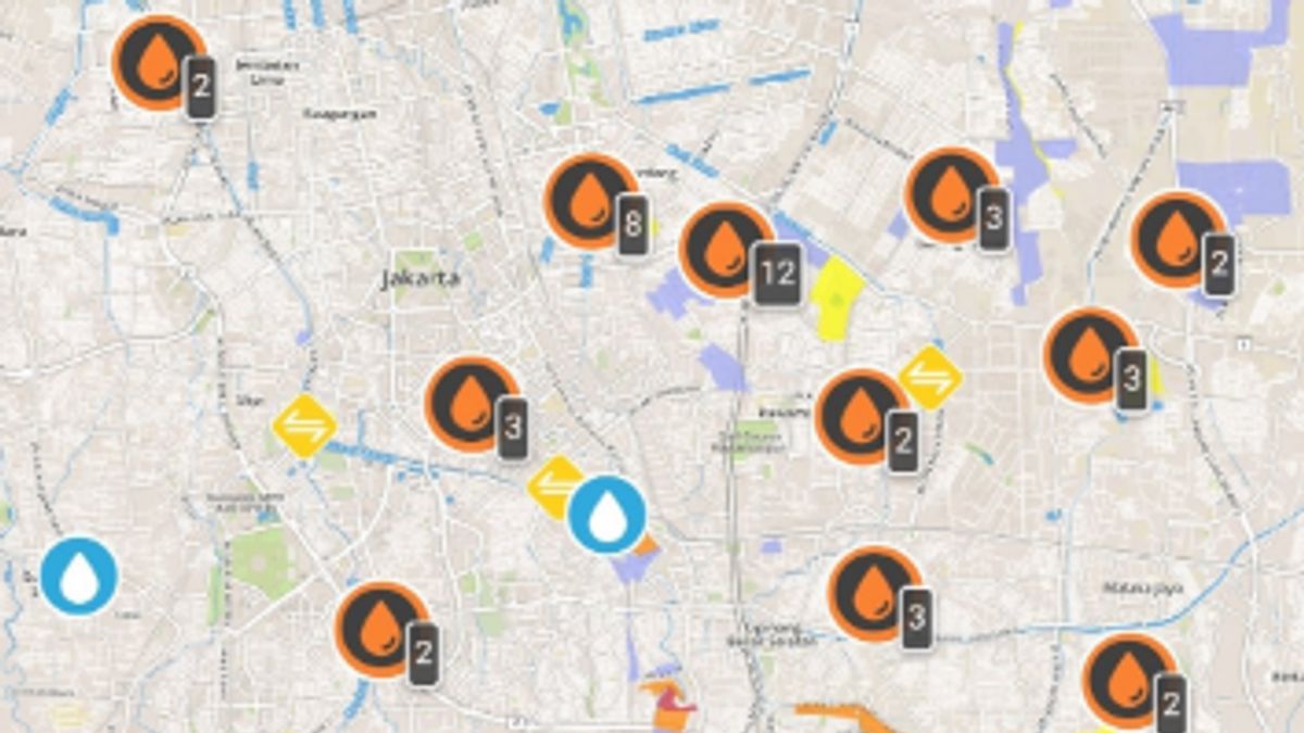
4. PetaBencana.id
This website is a portal that provides information about flood points in Jakarta and its surroundings. PetaBencana.id is a project under the auspices of the Peta Bencana Foundation as a free platform for the community.
The ability of this site is quite up-to-date, by utilizing realtime information from social media. Moreover, this site has been supported by many parties including USAID, UrbanRISKLab, BNPB, Pacific Disaster Center, Humanitarian OpenStreetMap Team, Qlue ,asangmata.com, Zurich and Mapbox.
55 reports from residents in the Jakarta area until 06.49 WIB at. Stay alert and report floods around you by tweeting "flood @petabencana" or report using Telegram https://t.co/9tqSupdljI with "/ flood". Or use local apps @qluesmartcity and @PasangMata pic.twitter.com/L2eVamjDNz
- PetaBencana.id (@petabencana) February 24, 2020
Apart from the application and website, the public can get the latest information about floods and other disasters through social media @infoBMKG, @BNPB_Indonesia and @BPBDJakarta. Others, related to the flood information that is busy on social media, people are urged to be careful in sorting out the news they get.
The English, Chinese, Japanese, Arabic, and French versions are automatically generated by the AI. So there may still be inaccuracies in translating, please always see Indonesian as our main language. (system supported by DigitalSiber.id)
Most Popular Tags
#Prabowo Subianto #donald trump #Febrie Adriansyah #8791 #giias 2026Popular


