

JAKARTA - Over the past few years, Google has used artificial intelligence to develop systems that can predict flooding by launching a tool called the Flood Hub globally.
This tool can help predict when flooding will occur and how deep the water is visually. The company uses an AI technique called transfer learning, this allows Google to make flood tracking work in areas that have less data.
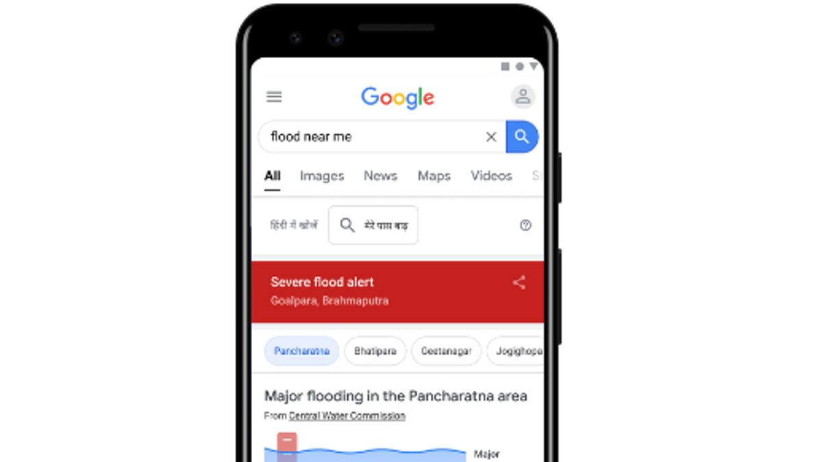
Using the Flood Hub, users can also enlarge certain areas and find local information, such as flood information for villages.
In 2021, Google has sent 115 million notifications of flood warnings to 23 million people. Now coverage will be extended to countries in South America, Africa Sub-Sahara and South Asia, adding to coverage in 18 additional countries.
Flood alerts will be sent to Android phone users and any phone with Google search app installed.
Launching The Verge, Friday, November 4, companies and other organizations can also sign up to receive flood warnings, but they must have access to the internet and activate Google location services on their phones to receive flood warnings.
In addition to the Flood Hub, Google also launched better forest fire tracking to several more countries after conducting a program test in the United States (US).
According to Google, their fire tracking system has covered more than 30 major fires in the US and Canada in real time, helping to alert members of the community and fire fighting team with more than 7 million views.
Now, the fire tracking system is extended to identify and track forest fires in real time and predict how they will develop and spread. Tech giants have achieved this change by advancing the use of satellite imagery to train AI models.
The English, Chinese, Japanese, Arabic, and French versions are automatically generated by the AI. So there may still be inaccuracies in translating, please always see Indonesian as our main language. (system supported by DigitalSiber.id)
Most Popular Tags
#Prabowo Subianto #donald trump #2026 World Cup #bgn #konflik timur tengahPopular


