

CENTRAL MALUKU - Head of the Meteorology, Climatology and Geophysics Agency (BMKG) Dwikorita Karnawati is willing to walk nearly 5 kilometers to determine a safe gathering point for residents of Amahai Country, Central Maluku Regency. Gathering points are prepared in the event of a tectonic earthquake and tsunami.
Dwikorita, started a survey with the BMKG team to match the map of the fault distribution area in the district, because almost all coastal areas are prone to tsunamis caused by landslides on the seabed.
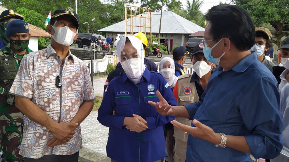
Accompanied by the Deputy Regent of Central Maluku, Marlatu Leleury, the Head of BMKG had to walk from the coast to higher and farther areas to find a safe gathering point for Amahai residents to protect themselves in the event of an earthquake and tsunami.
The move was taken considering that Amahai was also hit by a tsunami in 1899 known as the "Seram Danger".
"This gathering point is an evacuation location for residents so as not to fall victim when the tsunami occurs. The coast of Amahai Country is in the red zone or is very prone to tsunamis," he said, quoted by Antara, Friday, September 3.
Determination of this gathering point is very important by considering the evacuation route and the speed with which residents save themselves when the tsunami arrives at the beach.
When walking to the location of the meeting point that has been set by the government of the State of Amahai, it turns out that it takes 20 minutes to arrive, because you have to walk around the back of the settlement.
The head of the BMKG assessed that the location was very safe because it was blocked by hills, but the travel time was too long, so it was feared that residents would be trapped during a tsunami.
Several alternatives and considerations were presented by the King of Amahai Country, Frederik Hallatu, including the route near the mangroves, but Dwikorita also stated that the alternative was not appropriate because the mangrove density was too small and the area was also a red zone.
Dwikorita said, based on the latest hazard map, a tsunami more than six meters high could potentially hit the country and other coastal villages, with an arrival time of six minutes.
Therefore, a faster evacuation time is needed for residents to arrive at the safe zone or at the assembly point.
"Residents have to arrive at a safe location in less than six minutes. That's why we need to look for other alternatives besides the route that has been determined," he said.
He advised the Amahai government and the Central Maluku district government to build a permanent and earthquake-resistant bridge across the river that divides the village, because the evacuation route through the river is shorter.
Dwikorita added that he and the BMKG team will help the Central Maluku Regency Government map out evacuation routes and mitigation scenarios that need to be carried out immediately, so that they are ready to face disaster hazards that can occur at any time.
The English, Chinese, Japanese, Arabic, and French versions are automatically generated by the AI. So there may still be inaccuracies in translating, please always see Indonesian as our main language. (system supported by DigitalSiber.id)


