

JAKARTA - The Meteorology, Climatology and Geophysics Agency (BMKG) issued an early warning of very high waves of up to six meters in a number of Indonesian waters on June 15-16. The potential for high waves in some of these areas can pose a risk to shipping safety.
"Very high waves ranging from 4.0 to 6.0 meters are likely to occur in the Indian Ocean west of Lampung, the Indian Ocean south of Banten-East Java," said Head of the BMKG Maritime Meteorology Center, Eko Prasetyo, in a written statement, Tuesday, June 15.
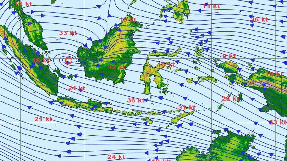
Eko said that the factors of the high waves include wind patterns in the northern part of Indonesia, which are dominantly moving from Southeast-Southwest with speeds ranging from 5-25 knots. Meanwhile, in the southern part of Indonesia, the dominant movement is from the East-Southeast at a speed of 5-20 knots.
"According to BMKG observations, the highest wind speeds were observed in the waters north of Sabang, the Sulawesi Sea, the waters of North Kalimantan and the Arafuru Sea south of Merauke," he said.
Eko explained that an increase in waves as high as 1.25-2.50 meters is likely to occur in several waters such as the northern part of the Malacca Strait, the eastern waters of Simeulue-Kep Island. Mentawai, southern Lampung Bay, southern waters of Sumbawa-P. Sawu, the southern part of the Sape Strait.
Then the western part of the Sumba Strait, the Sawu Sea, the southern waters of Kupang-P. Rote, southern Indian Ocean P. Sumba-P. Rote, the central and eastern Java Seas, the southern waters of Central Kalimantan, the southern and northern Makassar Straits, the waters of North Kalimantan, the Sulawesi Sea, the central and eastern Arafuru Seas.
Meanwhile, higher waves in the range of 2.50 - 4.0 meters are likely to occur in several other Indonesian waters including the northern waters of Sabang, the western waters of Aceh-Kep. Mentawai, Enggano-Bengkulu waters, West Lampung waters, West Indian Ocean Aceh-Kep. Mentawai, the western and southern parts of the Sunda Strait, the southern waters of Java-Lombok, the southern part of the Bali-Lombok-Alas Strait, the Indian Ocean south of Bali-NTB.
Eko emphasized that BMKG always urges the public to always be vigilant, especially for fishermen who are active in transportation modes. Such as fishing boats (wind speed more than 15 knots and wave height above 1.25 m), barges (wind speed more than 16 knots and wave height above 1.5 m).
Then ferries (wind speed more than 21 knots and wave height above 2.5 m), and large ships such as cargo ships/cruise ships (wind speed over 27 knots and wave height above 4.0 m).
"For this reason, it is requested that people who live and work on the coast around areas that have the potential for high waves to occur to remain vigilant," said Eko.
The English, Chinese, Japanese, Arabic, and French versions are automatically generated by the AI. So there may still be inaccuracies in translating, please always see Indonesian as our main language. (system supported by DigitalSiber.id)


