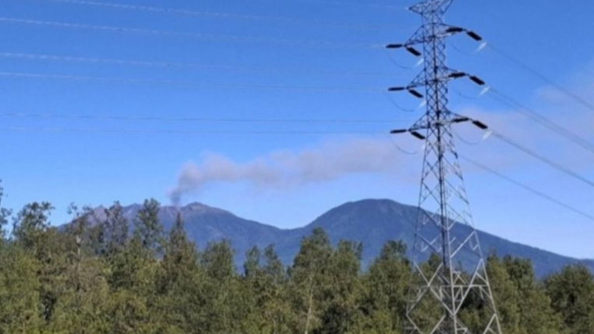


JAKARTA - The Geological Agency of the Ministry of Energy and Mineral Resources (ESDM) said that Mount Raung, which is located in Bondowoso Regency, East Java, erupted when its activity was at Level II or Alert status.
Head of the Geological Agency of the Ministry of Energy and Mineral Resources Muhammad Wafid said the main eruption with a column height of ash reaching about 600 meters above the peak of Mount Raung occurred on Thursday at 12.25 WIB.
The ash column was observed by officers from the monitoring post of Mount Raung in white to gray with moderate intensity and headed northeast.
Seismic footage from the monitoring post is currently being dominated by tremors, and the eruption is still ongoing when this report is drawn up.
"Although the eruption activity is still ongoing, the Geological Agency assesses that there has been no significant increase in seismic energy," he said as quoted by ANTARA, Thursday, June 5.
According to him, the earthquake of Mount Raung during the first week of June 2025 was dominated by gusts, with the number of events between three and ten times per day. In addition, there were also one deep volcanic earthquake and four continuous tremors with a dominant amplitude of one millimeter.
SEE ALSO:

"The eruption is expected to originate from shallow depth, and the distribution of ash is limited around the crater and northeastern sector. The level of activity remains relevant at Level II or alert," he said.
People, tourists, and climbers are advised not to approach the eruption center area in the crater of the peak of Mount Raung within a radius of three kilometers, and not to go down the caldera or spend the night around the crater. The appeal is in accordance with safety provisions that apply when the mountain is Level II or Alert.
The English, Chinese, Japanese, Arabic, and French versions are automatically generated by the AI. So there may still be inaccuracies in translating, please always see Indonesian as our main language. (system supported by DigitalSiber.id)
Most Popular Tags
#Prabowo Subianto #donald trump #2026 World Cup #Febrie Adriansyah #8791Popular


