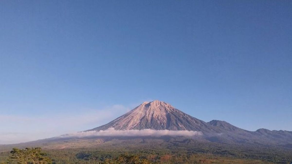


JAKARTA - Head of the Center for Volcanology and Geological Hazard Mitigation P Hadi Wijaya said the status of Mount Semeru, which is located on the border of Lumajang and Malang Regencies, East Java, has dropped from alert or level III to alert or level II.
"Based on the results of a thorough analysis and evaluation until July 14, 2024, the activity level of Mount Semeru will start from July 15, 2024 at 15.00 WIB, down from alert to alert," he said as quoted by ANTARA, Monday, July 15.
According to him, the evaluation results showed that the activity of Mount Semeru until July 14, 2024 showed that the eruption, hot clouds, and lava avalanches were still happening, but visually rarely being observed because of the foggy weather constraints.
"In that period, there was an increase in the occurrence of eruptions and lava avalanches which at any time had the potential to cause hot clouds," he said.
Data shows the occurrence of hot clouds observed since January 2023 generally 800-300 meters from the peak and lava avalanches observed generally 200-2,500 meters from the peak of Semeru.
The accumulation of eruptive material (uplets and lava flows) as well as the formation of a rice cone has the potential to become incandescent lava avalanches or hot clouds, then lava avalanche material or hot clouds that have been deposited along the river flow that originates at the peak of Semeru has the potential to become lava when interacting with rainwater.
"The interaction of lava avalanche material deposits or hot clouds with high temperature with river water will have the potential for secondary eruptions," he said.
He explained that the monitoring of deformation with tiltmeter equipment during that period showed a horizontal pattern indicating no increase in pressure within the volcano and a consistent displacement of pressure from within the volcano to the surface along with the release of material during eruptions and gusts.
"In connection with the decline in activity of Mount Semeru at level II or alert, we recommend that people do not carry out any activities in the southeast sector along Besuk Kobokan as far as 8 km from the summit," he said.
Beyond that distance, people are not allowed to carry out activities at a distance of 500 meters from the riverbank (river border) along Besuk Kobokan because it has the potential to be affected by the expansion of hot clouds and lava flows up to a distance of 13 km from the summit.
SEE ALSO:
-
 | BERITA
Trump di Pesawat Menuju Konvensi Partai Republik: Saya Seharusnya Sudah Mati
15 Juli 2024, 15:53

PVMBG also appealed to the public not to move within a 3 km radius of the crater or peak of Mount Semeru because it is prone to the dangers of incandescent stones.
"The public is also asked to be aware of the potential for hot clouds, lava avalanches, and lahars along rivers/valleys that originate at the top of Mount Semeru, especially along Besuk Kobokan, Besuk Bang, Besuk Kembar, and Besuk Sat," he said.
The decline in the status of the highest mountain on the island of Java was also conveyed to the Lumajang Regency Government which was forwarded to the local district Disaster Management Agency (BPBD).
The English, Chinese, Japanese, Arabic, and French versions are automatically generated by the AI. So there may still be inaccuracies in translating, please always see Indonesian as our main language. (system supported by DigitalSiber.id)
Most Popular Tags
#Prabowo Subianto #donald trump #2026 World Cup #Febrie Adriansyah #8791Popular


