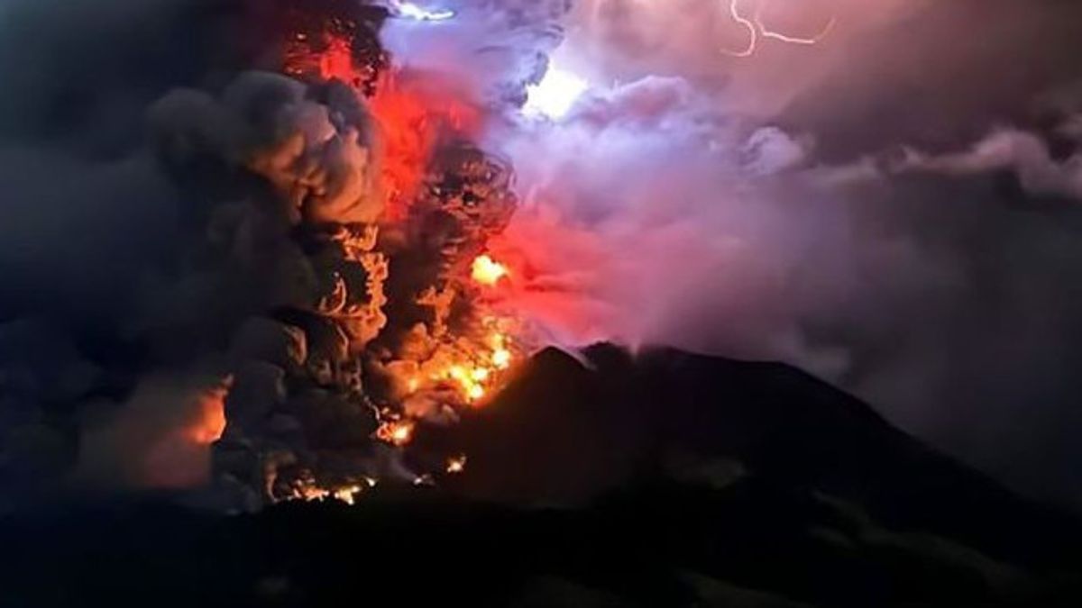


The Center for Research and Development of Geological Disaster Technology (BPPTKG) appealed to the public to carry out activities within a radius of 3 kilometers from the summit of Mount Merapi, which is now at level three on standby.
Mount Merapi, which borders the Special Region of Yogyakarta (DIY) and Central Java (Central Java), issued 20 hot alerts on Monday, July 1 morning until evening.
At 06.00 WIB in the morning, 6 lava avalanches were observed to the southwest or Bebeng River with a maximum sliding distance of 1,600 meters. Mount Merapi again emitted hot clouds once at 07.47 WIB with a sliding distance of 1,000 meters. Meanwhile, at 20.28 WIB, Mount Merapi again emitted 13 hot alerts.
BPPTKG said that the current potential danger is in the form of lava avalanches and hot clouds in the south-southwest sector covering the Boyong River for a maximum of 5 kilometers, the Bedog River, Krasak, Bebeng for a maximum of 7 kilometers.
In the southeast sector, including the Woro River is a maximum of 3 kilometers and the Gendol River is 5 kilometers. Meanwhile, the ejection of volcanic material in the event of an explosive eruption can reach a radius of 3 kilometers from the summit.
SEE ALSO:


According to BPPTKG, monitoring data shows that the supply of magma is still ongoing which can trigger hot clouds of avalanches in potential hazard areas.
People should not carry out any activities in areas of potential danger. The public must be aware of the dangers of lava and hot clouds avalanches (APG), especially when it rains around Mount Merapi," said BPPTKG officer Yulianto.
The English, Chinese, Japanese, Arabic, and French versions are automatically generated by the AI. So there may still be inaccuracies in translating, please always see Indonesian as our main language. (system supported by DigitalSiber.id)
Most Popular Tags
#Prabowo Subianto #donald trump #2026 World Cup #venezuela #konflik timur tengahPopular


