

The Center for Volcanology and Geological Hazard Mitigation (PVMBG) of the Ministry of Energy and Mineral Resources reported the results of a preliminary investigation regarding the movement of land around Mount Marapi located in Agam Regency and Tanah Datar Regency, West Sumatra Province.
"The movement of the soil in the form of a flow of raw materials (banjir bandang) that occurred in Tanah Datar Regency and Agam Regency is a flow of dilute material in the form of a mixture of materials originating from deposits of rock, sand, volcanic ash and trees," said Head of PVMBG Hendra Gunawan quoting Antara.
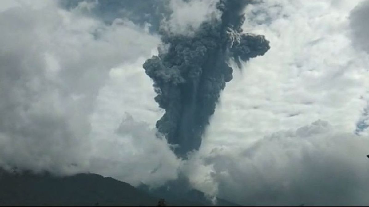
Hendra said the flash flood was triggered by the high intensity of rainfall with a long duration that hit the upstream of the river at the top of Mount Marapi.
In general, the morphology of disaster locations and their surroundings is in the form of moderate to high waves of plains. The land area of flash floods is in the form of an alumcial fan plateau located on the lower slopes of the hills. The height of the disaster site varies from 460 to 1,290 meters above sea level (MDPL).
Then, for the geology of areas affected by flash floods, it is an alumcial area consisting of rock produced from erosion and rhombakan. Materials flow from the main component of the competition material in the form of round, round rock infiltration, wood, and lava lumps with a composition of 50 to 100 centimeters.
In fact, some of them are in the form of chunks measuring two to three meters and rocks with a Andesytic composition of sand size to lump with a sand matrices and silt deposits.
Based on the geological map of Mount Marapi, rock that makes up volcanic rock in the form of lava, pyroclastic flow, and tepra products in the form of pyroclastics and lahars.
SEE ALSO:
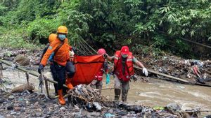


From the results of the investigation conducted by PVMBG, said Hendra, the areas affected by cold lava floods have been used as settlements, agriculture to public facilities such as roads, bridges and other facilities.
"The use of land at the top is forest and most of it has changed to fields and gardens. Then on the slopes the middle part is worked on to become rice fields and gardens or community fields," he said.
Based on a map of the area forecast for land movement in West Sumatra in April, disaster areas in Tanah Datar Regency and Agam Regency include medium to high potential.
"In this zone, there is the potential for flow of raw materials and movement of land or landslides, especially areas bordering river valleys, gawir, road cliffs or if slopes experience disruption," he said.
The English, Chinese, Japanese, Arabic, and French versions are automatically generated by the AI. So there may still be inaccuracies in translating, please always see Indonesian as our main language. (system supported by DigitalSiber.id)


