

JAKARTA - The Geological Agency of the Ministry of Energy and Mineral Resources noted an increase in earthquake activity over the past month at Mount Slamet in Central Java.
"The seismic activity is dominated by gusts and tremors that indicate fluid movement activity around the surface," said Head of the Geological Agency Muhammad Wafid as reported by ANTARA, Saturday, May 11.
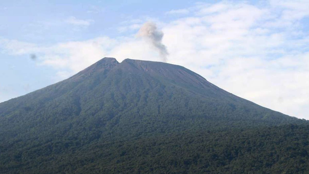
Mount Slamet is a conical strato volcano with a peak height of 3,432 meters above sea level.
Administratively, the type A volcano is located in five districts in Central Java, namely Pemalang Regency, Banyumas Regency, Brebes Regency, Tegal Regency, and Purbalingga Regency.
Mount Slamet, which is currently still on alert status or level II, is monitored visually and instrumentally from the Gunungapi Observation Post (PPGA) located in Gambuhan Village, Gajah Nguling, Pulosari District, Pemalang Regency, Central Java.
Based on observations from April 1 to 15, 2024, the Geological Agency recorded 197 earthquake gusts, 1 deep volcanic earthquake, 1 local tectonic earthquake, 12 distant tectonic earthquakes, and continuous tremors with an amplitude of 0.5 to 1 mm (dominant of 0.5 millimeters).
On April 16 to 30, 2024, the Geological Agency recorded 701 earthquake gusts, 1 earthquake was felt, 8 distant tectonic earthquakes, and continuous tremors with a dominant amplitude of 0.5 millimeters.
Then, the observation period of May 1 to 9, 2024, recorded 902 gust earthquakes, 15 deep volcanic earthquakes, 3 distant tectonic earthquakes, and continuous tremors with an amplitude of 0.5 to 3 millimeters (dominant 1 millimeter).
Deformation monitoring activities using electronic distance measurement show fluctuations in decreasing futures that tend to be stable with relatively small distance changes.
On May 1-10, 2024, a significant change in the results of the oblique distance measurement was not observed.
The Geological Agency monitors deformation using a tiltmeter at Cilik Station which is at an elevation of 1,500 meters above sea level (masl), Bambangan Station at an elevation of 1,875 meters above sea level, and Sawangan Station at an elevation of 2,000 meters above sea level.
SEE ALSO:


In the period 1-10 May 2024 monitoring of the deformation of the Mount Slamet tiltmeter from Sawangan Station showed a relative pattern of increasing on the Y component (radial).
Wafid explained that the results of monitoring data showed an increase in pressure under Mount Slamet which could trigger shallow earthquakes and eruptions.
The current potential hazard is a phreatic and magnesium eruption that can produce the ejection of incandescent material that hit the area around the peak within a radius of 2 kilometers.
"Rains of ash can occur around craters or hit areas determined by wind direction and speed," said Wafid.
The Geological Agency asked the public not to be located or active within a two-kilometer radius of the crater peak of Mount Slamet considering the alert status which is currently still embedded since October 19, 2023.
The English, Chinese, Japanese, Arabic, and French versions are automatically generated by the AI. So there may still be inaccuracies in translating, please always see Indonesian as our main language. (system supported by DigitalSiber.id)
Most Popular Tags
#Prabowo Subianto #donald trump #2026 World Cup #bgn #konflik timur tengahPopular


