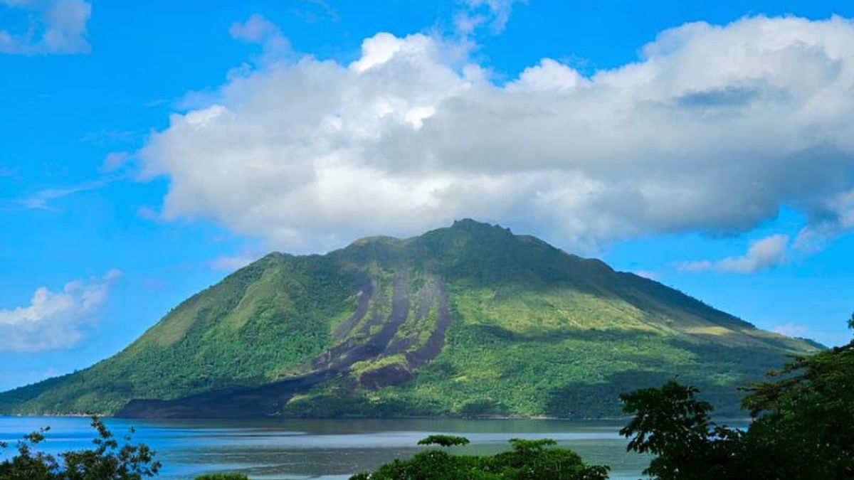
MALUKU - The tectonic earthquake that rocked Doi Island twice in North Maluku has triggered volcanic upheaval in Mount Ruang located in Sitaro Regency, North Sulawesi (Sulut).
The Center for Volcanology and Geological Hazard Mitigation (PVMBG) today announced the increase in the status of Mount Ruang from normal or Level I to Alert or Level II.
"The emergence of deep volcanic earthquakes is usually related to magma migration from depth to surface," said PVMBG Head Hendra Gunawan in a report received in Jakarta, Tuesday.
On April 9, 2024, a tectonic earthquake measuring 6.4 magnitudes with a depth of 27 kilometers was recorded located 94 kilometers northwest of Doi Island, North Maluku.
Five days later on April 14, 2024, a tectonic earthquake measuring 5.1 magnitude with a depth of 10 kilometers was recorded located 122 kilometers southwest of Doi Island, North Maluku. Both earthquakes were felt on a scale I MMI.
Hendra explained that the volcanic activity of Mount Ruang for the period of April 1-15, 2024, apart from being dominated by distant tectonic earthquakes, there was also an escalation of the emergence of volcanic earthquakes in the post-two strong tectonic earthquakes that occurred on April 9 and April 14, 2024.
In the period 1−15 April 2024, he said, the earthquake of Mount Ruang was recorded as many as 210 deep volcanic earthquakes, 3 local tectonic earthquakes, and 163 distant tectonic earthquakes. The earthquake was recorded twice on the MMI scale.
The number of seismicities, especially volcanic earthquakes, in the period 1-15 April saw a significant increase compared to March 2024.
Volcanic activity of Mount Ruang until the period of April 15, 2024, is still dominated by distant tectonic earthquakes. However, post-tectonic earthquake and felt in the Mount Ruang area recorded an increase in the number of deep volcanic earthquakes, namely: 10 April 2024 (4 times), 11 April 2024 (5 times), 12 April 2024 (6 times), 13 April 2024 (17 times), 14 April 2024 (23 times) and 15 April 2024 (146 times).
"In general, the volcanic seismicity in Mount Ruang tends to be low, more dominated by tectonic earthquakes, it is estimated that the influence of North Sulawesi subduction and double subduction in the Maluku Sea are," said Hendra.
PVMBG recommends the public not to approach the active crater of Mount Ruang at a radius of two kilometers, visitors are not allowed to stay in an active crater area, and not to approach the gas seepage hole around the crater to avoid potential toxic gas hazards.
Although the status has increased to Alert, he continued, the community is expected to be calm and active as usual, and not be provoked by rumors about the eruption of Mount Ruang.
"The level of activity of Mount Ruang will be re-evaluated periodically, or if there is a significant change in activity. The level of activity is considered fixed if the next evaluation has not been issued," said Hendra.
SEE ALSO:
The English, Chinese, Japanese, Arabic, and French versions are automatically generated by the AI. So there may still be inaccuracies in translating, please always see Indonesian as our main language. (system supported by DigitalSiber.id)
Most Popular Tags
#Prabowo Subianto #NCP #Palestine #tangerang sea fence #budget efficiency #iims 2025Popular
17 Februari 2025, 00:27
17 Februari 2025, 02:02
17 Februari 2025, 01:48
17 Februari 2025, 03:15


