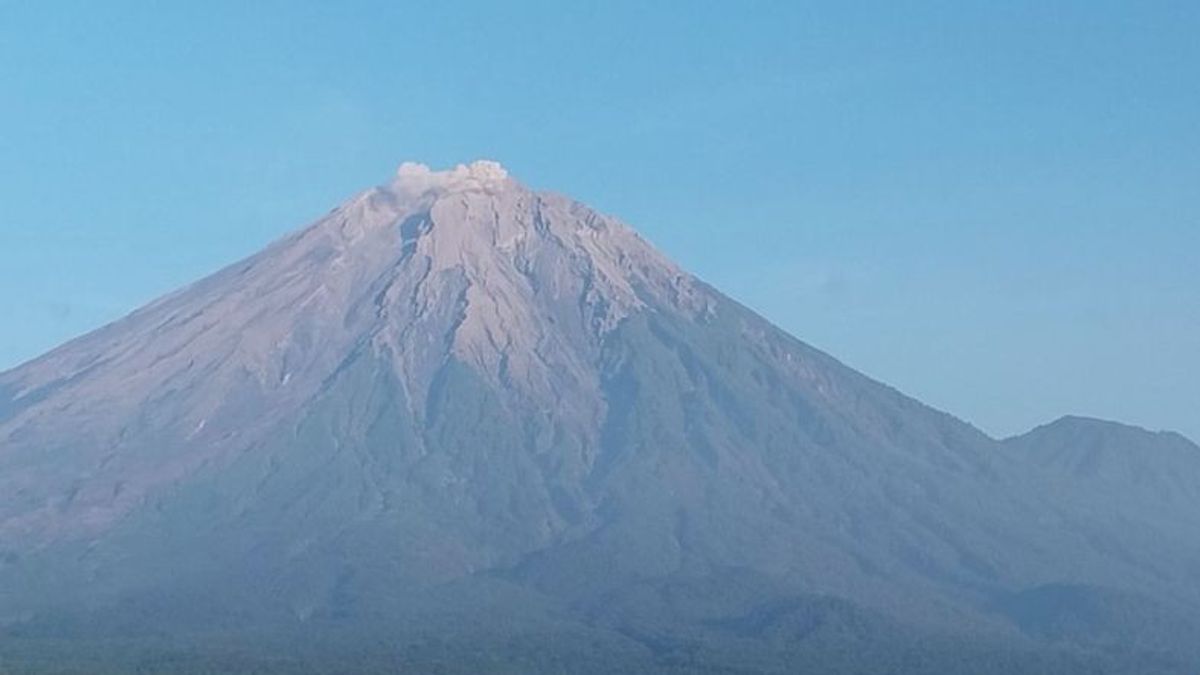


Mount Semeru, which is on the border of Lumajang and Malang regencies, East Java, erupted with a column of volcanic ash as high as 500 meters above the peak at 06.10 WIB.
Based on a report from the Mount Semeru Observation Post officer, Liswanto, the mountain, which has a height of 3,676 meters above sea level (masl), erupted twice on Saturday, April 6, at 05.11 and 06.10 WIB.
"There was an eruption of Mount Semeru on Saturday, April 6, 2024, at 06.10 WIB. The height of the eruption column was observed to be about 500 meters above the peak or around 4,176 mdpl," he said, quoted by ANTARA.
The volcanic ash column was observed to be white to gray with moderate intensity to the north and the eruption was still ongoing when the report was made.
The eruption at 05.11 WIB was recorded as high in the volcanic ash column as 400 meters above the peak or 4,076 meters above sea level. The ash column was observed to be white to gray with moderate intensity to the northeast.
SEE ALSO:
-
 | BERITA
AS Nyalakan Sinyal Waspada ‘Balas Dendam’ Iran Buntut Serangan Israel di Suriah
06 April 2024, 08:29

Mount Semeru is still on alert or level III, so the Center for Volcanology and Geological Hazard Mitigation (PVMBG) recommends that people be prohibited from carrying out any activities in the southeast sector along Besuk Kobokan, as far as 13 km from the summit (the center of the eruption).
Beyond this distance, the public is asked not to carry out activities at a distance of 500 meters from the riverbank (river border) along Besuk Kobokan because it has the potential to be affected by the expansion of hot clouds and lava flows up to a distance of 17 km from the summit.
The English, Chinese, Japanese, Arabic, and French versions are automatically generated by the AI. So there may still be inaccuracies in translating, please always see Indonesian as our main language. (system supported by DigitalSiber.id)
Most Popular Tags
#Prabowo Subianto #donald trump #2026 World Cup #Febrie Adriansyah #8791Popular


