

JAKARTA - The Meteorology, Climatology and Geophysics Agency (BMKG) has asked the people of southern Central Java (Central Java) to be aware of strong winds that have the potential to occur for the next few days.
"The potential for strong winds was also triggered by the seeds of tropical cyclone 91S in the south of Java Island," said Head of the BMKG Technician Group at Tunggul Wulung Station in Cilacap, Teguh Wardoyo in Cilacap, Tuesday.
In this case, he said, the seeds of tropical cyclone 91S are in the Indian Ocean southwest of Banten moving to the southeast or south of Java Island.
He said that based on monitoring until 10.15 WIB, the maximum wind speed in the urban area of Cilacap recorded by the Tunggul Wulung Meteorological Station reached 18 knots, while at the Tunggul Wulung Airport Meteorological Post Cilacap was 17 knots.
"In addition to strong winds, the public needs to be aware of the potential for heavy rain triggered by several factors, one of which is the seeds of tropical cyclone 91S," he said.
According to him, another factor that has the potential to trigger rain with moderate to heavy intensity which is sometimes accompanied by lightning and strong winds in the form of the active Madden Julian Oscillation (MJO) in phase 3 (Basic Ocean), thus showing significant conditions for increasing rainfall in Indonesia.
Furthermore, Asian monsun activity has an effect on increasing the wet air mass in the western and southern parts of Indonesia, the equator, including around the Central Java region, the active atmosphere waves Rossby Ekuator in most parts of Indonesia including Central Java, convergence areas and wind bends were observed around Central Java, as well as strong local lability that supports convective processes on local scales observed in Central Java.
"This condition causes an increase in the potential for extreme weather in the form of rain with moderate to heavy intensity which can be accompanied by lightning and strong winds in a number of areas of Central Java on March 12-14," he said.
SEE ALSO:
-
 | BERITA
Enam Hari Beroperasi, ETLE Drone Sudah ‘Tangkap’ Ribuan Pelanggar Lalu Lintas
12 Maret 2024, 08:02 -
 | BERITA
Penanganan Banjir Sumbar Ditarget Rampung Dua Pekan untuk Kembali Normal
12 Maret 2024, 07:30 -
 | BERITA
Dua Warga Tewas Keracunan Gas Saat Evakuasi Bangkai Kucing di Dalam Sumur
03 Maret 2024, 22:14


Teguh said areas that have the potential for extreme weather on March 12-14 include Cilacap, Banyumas, Purbalingga, Banjarnegara, Wonosobo, Boyolali, Klaten, Grobogan, Blora, Rembang, Pati, Kudus, Demak, Temanggung, Kendal, Batang, Pemalang, Brebes, Salatiga City, Magelang Regency/City, Semarang Regency/City, Tegal Regency/City, Pekalongan Regency/City, and surrounding areas.
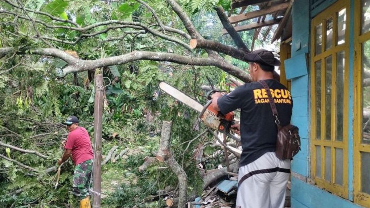
On a separate occasion, the Head of the Banyumas Regency Regional Disaster Management Agency (BPBD) Budi Nugroho said that based on a temporary report, as many as six incidents of fallen trees due to strong winds occurred from Monday (11/3) to Tuesday (12/3) morning.
According to him, the six incidents of fallen trees were scattered in Cikembulan, Cibangkong, and Kranggan villages, Pekuncen District; Sawangan and Jingkang, Ajibarang District; and Sunyalangu, Karanglewas District.
"Therefore, we urge residents to always be aware of the potential for strong winds and other extreme weather as warned by the BMKG," he said.
The English, Chinese, Japanese, Arabic, and French versions are automatically generated by the AI. So there may still be inaccuracies in translating, please always see Indonesian as our main language. (system supported by DigitalSiber.id)


