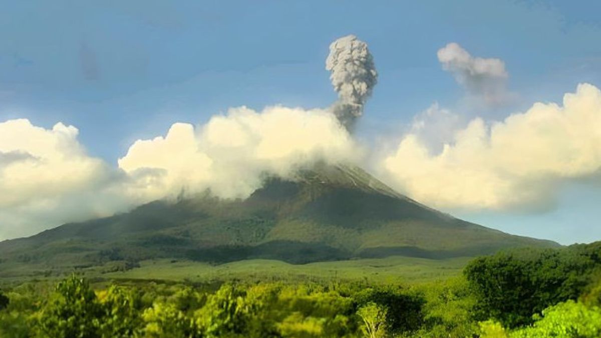
NTT - Center for Volcanology and Geological Hazard Mitigation (PVMBG) reported that the status of Mount Ile Lewotolok in Lembata Regency, East Nusa Tenggara (NTT), has increased its status from Alert to Alert.
Head of the Center for Monitoring of Volcano and Disaster Mitigation of the Land Movement of the Nusa Tenggara Region, Zakarias Ghele Raja, said the increase in status was due to a significant increase in activity.
"Based on the results of a thorough analysis and evaluation until February 26, 2024, it shows a significant increase in activity, so the activity level of Mount Ile Lewotolok starting from 27 February 2024 at 10.00 WITA is raised from Level II to Level III," he said when contacted, Tuesday, February 27, was confiscated by Antara.
He said this status increase was also determined based on the results of the evaluation of the development of volcanic activity in the mountain for the period Saturday, February 24 to Monday, February 26.
During that period, he continued, there was an eruption with an altitude of approximately 200 to 1,000 meters from the summit.
In addition, there were also avalanches, visually the distance and direction of the slide ranged from 300 to 1,000 meters from the summit with a sliding direction to the southeast to south region.
Even on February 15, new lava flows emerged both to the south and to the southeast as far as 400 meters from the crater's lips.
"As of February 26, the new lava flow has reached a distance of two kilometers to the southeast with a fairly fast lava flow rate," he said.
Meanwhile, based on seismic data in the period 16 to 26 February, 98 earthquakes were recorded due to eruptions, 30 earthquake avalanches, 3,615 earthquake gusts and 98 non harmonic tremors.
Until now, he said, explosive eruptions were still ongoing with the dominant lava coverage around the crater area, but could also reach 500 meters out of the crater.
Therefore, PVMBG has issued an appeal to the community around the mountain as well as visitors, climbers, and tourists, not to enter and not to carry out activities within a two-kilometer radius of the center of Mount Lewotolok. Then the people of Lamawolo Village, Lamatokan Village, and Jontona Village should always be aware of the potential threat of avalanche/longsoran lava and hot clouds from the eastern tip of the mountain crater.
SEE ALSO:
Communities around Mount Lewotolok as well as the people of Jontona Village and Todonara Village should not enter and not carry out activities within the southern and southeast sectoral areas as far as four kilometers from the center of mountain activity.
People in Jontona Village should also always be aware of the potential threat of avalanches or avalanches of lava and hot clouds from the southern and Southeast sides of the crater of Mount Lewotolok.
Besides that, people who live around the valleys/rivers that originate at the top of Mount Ile Lewotolok should always be aware of the potential threat of lava hazards that can occur, especially during the rainy season.
The English, Chinese, Japanese, Arabic, and French versions are automatically generated by the AI. So there may still be inaccuracies in translating, please always see Indonesian as our main language. (system supported by DigitalSiber.id)


