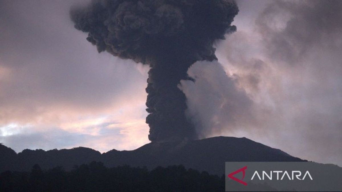


The Ministry of Energy and Mineral Resources (ESDM) of the Geological Agency conveyed that Mount Marapi in Agam Regency and Tanah Datar Regency, West Sumatra is still at level III or on standby.
"Based on the results of a thorough analysis and evaluation until January 16, 2024, the activity level of Mount Marapi remains at level III (standby) with recommendations that are adjusted to the latest potential/danger threat," said Head of the Center for Volcanology and Geological Hazard Mitigation (PVMBG) Hendra Gunawan as reported by ANTARA, Thursday, January 18.
Still in the PVMBG report, after the eruption on December 3, 2023, until now the continued eruption of Mount Marapi is still happening.
The number of daily eruptions tends to decrease fluctuately. However, the number of frequency and volcanic earthquakes tends to increase which indicates the supply of magma from depth is still happening and tends to increase.
Hendra said that the current volcanic activity of Mount Marapi is still relatively high, which is reflected in the activity of eruptions and visually observed, as well as earthquake eruptions and gusts that are still recorded accompanied by continuous tremors.
The data on sulfur dioxide (SO2) gas from the Sentinel satellite also shows that the emission rate is still relatively high as an indication that the current eruption is magmatic.
In this regard, as an effort to mitigate, the level of activity of Mount Marapi has been raised from level II (alert) to level III (standby) starting January 9, 2024 at 18.00 WIB.
SEE ALSO:
-
 | BERITA
Janji Benahi BPJS Kesehatan, Anies: Prinsipnya Kesetaraan, Siapa Biayai itu Nomor Dua
18 Januari 2024, 16:36 -
 | BERITA
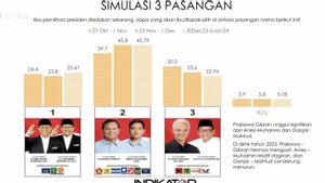
Survei Indikator: Elektabilitas Prabowo-Gibran Stagnan, AMIN Naik, Ganjar-Mahfud Turun
18 Januari 2024, 16:04

This condition has the potential to pose a danger if the supply of magma from depth continues and tends to increase, the eruption can occur with greater energy with the potential/threat of danger from the ejection of rock-sized volcanic material (bombs), lapili, or sand which is estimated to reach a radius of 4.5 kilometers from the eruption/Verbeek Center.
Meanwhile, the potential or threat from the ash eruption can spread more/far away or depending on the direction and speed of the wind.
Then the eruption material that falls and deposits at the top and slopes of Mount Marapi can become lava when mixed with rainwater.
"Therefore, there is a potential danger from the flow/flood of lahars in the valleys/flows of rivers that originate at the top of Mount Marapi," he explained.
Finally, there is the potential danger of toxic volcanic gases such as carbon dioxide, carbon monoxide, sulfur dioxide, and hydrogen sulfide in the crater/peak area of Mount Marapi.
The English, Chinese, Japanese, Arabic, and French versions are automatically generated by the AI. So there may still be inaccuracies in translating, please always see Indonesian as our main language. (system supported by DigitalSiber.id)
Most Popular Tags
#Prabowo Subianto #donald trump #Febrie Adriansyah #8791 #giias 2026Popular


