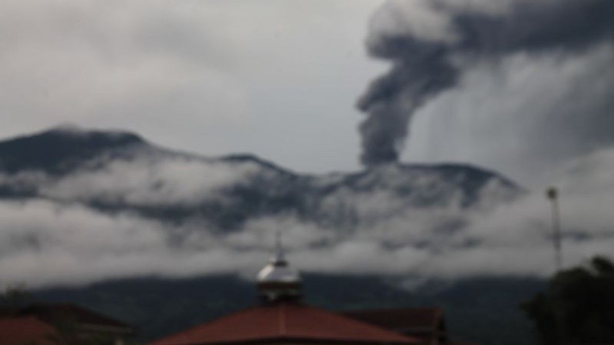


LUBUK BASUNG - As many as 100 residents in Nagari or Batu Palano Village, Agam Regency, West Sumatra are in the red zone or areas declared unsafe by the Center for Volcanology and Geological Disaster Mitigation (PVMBG) of the Marapi eruption.
"There are 100 of our residents with 100 families or 174 houses located at a radius of 4.5 kilometers or the unsafe zone of Mount Marapi is in Jorong Batang Salasiah Rubai Hantantiang," said Wali Nagari or the Head of Batu Palano Firdaus Village as reported by ANTARA, Wednesday, January 10.
Firdaus also regretted that in mapping preparedness at the coordination meeting with BPBD and TNI-Polri and PVMBG, it was not explained that there were residential areas in it.
"This is what we regret because in the map there are several houses that are not in the map so that they are not detected at a radius of 4.5 kilometers," said Firdaus.
Before that there were community settlements. For example, the Tambek Gadang and Rubai Hantantiang areas where there were small areas called Bareco. It's not on the map," he continued.
Firdaus emphasized that residents who are within a radius of 4.5 kilometers from the top of Marapi about the slopes of the mountain can be given comprehensive education as a measure to anticipate disaster preparedness.
"The most important thing that is needed at this time is valid information so that residents can understand because if we and the disaster prepared group that conveys it sometimes are not accepted," he said.
Even the residents thought level III was a safe level and level II was unsafe, this information was not optimally running.
SEE ALSO:
-
 | BERITA
Laporan Pengeluaran Dana Kampanye PSI Cuma Rp180 Ribu, Bawaslu: Enggak Logis
10 Januari 2024, 16:23 -
 | BERITA
Ganjar Bantah Jokowi Pecah Kongsi Gara-gara Tak Hadiri HUT ke-51 PDIP
10 Januari 2024, 16:26 -
 | BERITA
Bawaslu Sebut Umpatan Prabowo Usai Debat Capres Berpeluang Masuk Pidana Pemilu
10 Januari 2024, 15:15
Meanwhile, Assistant to the Agam Regency Government Rahman said that his party could not confirm the existence of residents who lived at a radius of 4.5 kilometers, so it was necessary to do a real mapping.
"This is what data collection needs to be done. We will do more data on whether those on the slopes of Mount Marapi are included in the zone. Maybe residents' anxiety to convey this is included, but it is not, so that there is certainty," he said.
The English, Chinese, Japanese, Arabic, and French versions are automatically generated by the AI. So there may still be inaccuracies in translating, please always see Indonesian as our main language. (system supported by DigitalSiber.id)
Most Popular Tags
#Prabowo Subianto #donald trump #2026 World Cup #venezuela #konflik timur tengahPopular


