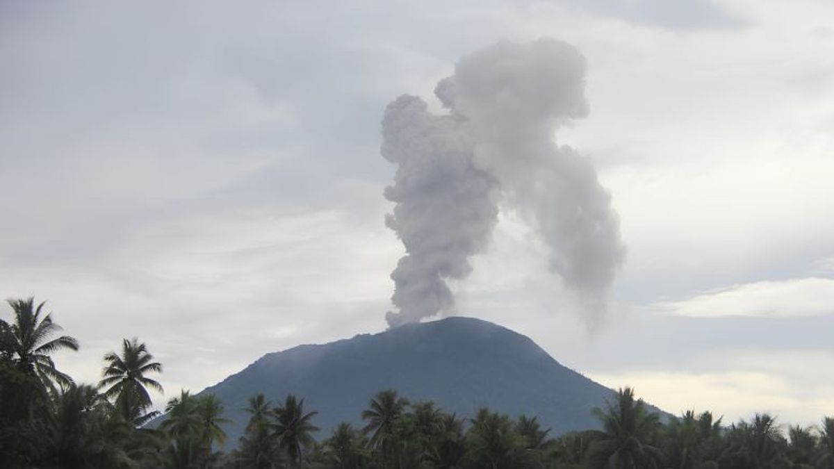


JAKARTA - Mount Ibu, located northwest of Halmahera Island, North Maluku Province, experienced an eruption asking for thick gray volcanic ash as high as approximately 1,000 meters to the southwest and west.
Mount Ibu Eferita Observation Post Officer Lusy Andriany Saragih said the eruption occurred at 08.56 WIT.
"When this report was made, the eruption was still ongoing," said Eferita in a report quoted by ANTARA, Friday, January 6.
Mount Ibu is a volcano-type volcano that has a height of 1,325 meters above sea level located northwest of Halmahera Island, North Maluku.
The top of the mountain is a volcanic crater. The crater center has a width of 1 kilometer and a depth of 400 meters, while the outer part has a width of 1.2 kilometers.
The Center for Volcanology and Geological Hazard Mitigation recommends the community around Mount Ibu not to move within a 2 kilometer radius and a sectoral expansion of 3.5 kilometers to the crater opening in the northern part of the active crater of the volcano.
SEE ALSO:
-
 | BERITA
3 Orang Dilaporkan Tewas Akibat Tabrakan Kereta Turangga dengan Commuter Line di Bandung
05 Januari 2024, 07:46 -
 | BERITA
BREAKING NEWS: Kereta Commuter Line Tabrakan dengan KA Turangga di Bandung
05 Januari 2024, 07:38


In the event of ash rain, people who are active outside the home are advised to use a nose, mouth (mask), and eyes (glasses).
On January 4, 2024, for the period from 00.00 to 24.00 WIT, PVMBG recorded hundreds of earthquakes arising from magmatic activity on Mount Ibu.
There were 21 earthquakes recorded, 33 gusts earthquakes, 4 harmonic earthquakes, 82 volcanic earthquakes, 1 volcanic earthquake, 1 tectonic earthquake, and 11 distant tectonic earthquakes.
The English, Chinese, Japanese, Arabic, and French versions are automatically generated by the AI. So there may still be inaccuracies in translating, please always see Indonesian as our main language. (system supported by DigitalSiber.id)
Most Popular Tags
#Prabowo Subianto #donald trump #Febrie Adriansyah #8791 #giias 2026Popular


