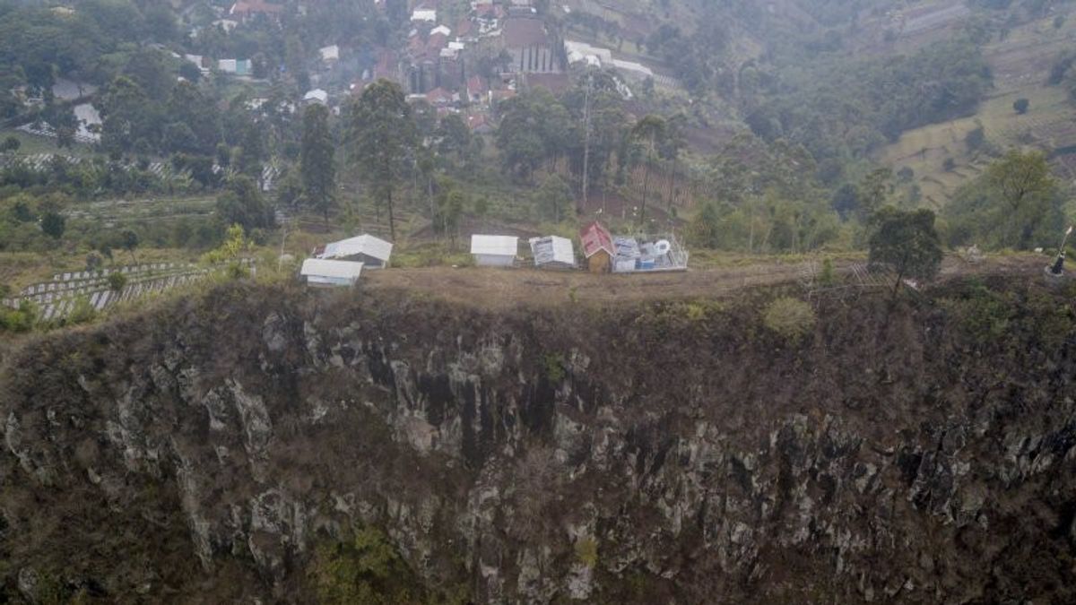
JAKARTA - The Meteorology, Climatology and Geophysics Agency (BMKG) has since 1963 monitored the activity of the Lembang Fault, an active fault in West Java, which is about 10 km north of Bandung City.
Reported by Antara, Wednesday, January 27, according to the Coordinator of Earthquake and Tsunami Mitigation BMKG Daryono in Jakarta, Wednesday, BMKG began installing and operating WWSSN (World Wide Standardized Seismograph Network) seismographs for the first time in Lembang on January 1, 1963.
In addition to monitoring earthquakes in Indonesia, the Benioff Short Period 3 Component and 3 Component Sprengneter type long period 3 component seismographs installed in the area are used to monitor the activity of the Lembang Fault, a fault along the 25-30 km east-west direction which according to experts has a magnitude targeted 6.8.
BMKG officials have long been observing records of local earthquakes on analog seismograms around Lembang.
Earthquake activity in the Lembang Fault route starting in 2008 can be better monitored because BMKG operates a digital earthquake monitoring network using earthquake sensors with a wide frequency area.
"It does not mean that prior to 2008 there was no earthquake activity in the Lembang Fault. The rare earthquake activity at that time was because the earthquake sensors were not as many as now, so that some local earthquake activities with small magnitudes were not recorded properly," said Daryono.
In 2019, BMKG installed 16 short-term seismic sensors more closely to complement the 19 wide-frequency seismographs that have been installed in West Java and Banten.
The earthquake sensor that was deliberately installed "surrounded" the Lembang, Cimandiri and Baribis Fault lines was installed for operational purposes and an active fault study.
The existence of an increasingly dense earthquake sensor is expected to be able to more accurately monitor active fault activity in West Java.
Lembang Fault activity can be seen from small earthquakes that still occur along the fault line.
According to research Supendi et al. (2018) published in the journal Geoscience Letters, during the period 2009-2015 four earthquake events were identified along the Lembang Fault route using the BMKG's regional earthquake sensor network.
Research conducted by Afnimar et al. (2015) showed that there was earthquake activity along the Lembang Fault. The results of the study used seismic data from four BMKG temporary seismic stations during the period May 2010 to December 2011 recorded nine earthquakes in the Lembang Fault.
On August 28, 2011 there was an earthquake with a magnitude of 3.3 with a very shallow depth resulting in a significant impact, causing damage to 384 houses in Muril Village, Jambudipa Village, Cisarua District, West Bandung Regency.
In addition, Nugraha and Supendi's research (2018) published in the Journal of Physics shows that there were two earthquake events on May 14 and 18 2017 in the Lembang Fault.
The earthquake with magnitudes 2.8 and 2.9 that occurred on 14 and 18 May 2017 had an impact on the MMI II-III intensity scale, but did not cause any damage.
Earthquake monitoring results in the Lembang Fault are very important to determine the level of earthquake activity, the distribution of the earthquake active zone, the mechanism of earthquake sources, and study of the subsurface structures of the earth through tomography techniques for mitigation purposes.
"Nobody knows when a strong earthquake will occur. To be safe from an earthquake, we can make concrete mitigation efforts by building earthquake-resistant houses and learning how to survive an earthquake," said Daryono.
The English, Chinese, Japanese, Arabic, and French versions are automatically generated by the AI. So there may still be inaccuracies in translating, please always see Indonesian as our main language. (system supported by DigitalSiber.id)


