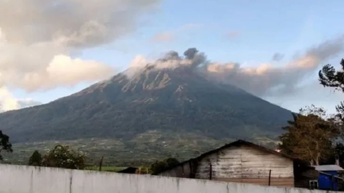
JAMBI - Gunung Kerinci experienced an eruption at 06.46 WIB with a duration of up to one hour 40 minutes, Saturday, February 4.
Officers of the Kerinci Volcano Monitoring Post, Irwan Safwan, said that there was a ash pond due to the eruption activity, where the ash pond was observed to be gray to brown with thick intensity leaning towards the East and Southeast.
"The height of the volcanic ash pond reaches 200 meters above the peak," he said, citing the between.
This eruption was recorded on a seismogram with a maximum amplitude of 2 mm. With the status of Mount Kerinci level two (alert), he said, people are still advised not to climb to the top of the mountain.
The flight path around Mount Kerinci was also avoided because of the potential for ash eruptions with heights that could disrupt flight routes.
Meanwhile, Head of the Regional Disaster Management Agency (BPBD) of Kerinci Regency, Dedi Andrizal, said there were several areas affected by the eruption of Mount Kerinci. One of them is in Pelompek Village, Gunung Tujuh Kerinci District which was also affected by eruption ash.
"I have confirmed with the Head of Gunung Tujuh Sub-district, it is true that the village is affected every time there is an eruption but people are used to it, so they are still active as usual," he said.
He continued to urge the public to be vigilant and always listen to information about the condition of Mount Kerinci from monitoring officers Gunung Kerinci and the government.
The Head of Emergency and Logistics of BPBD, Kerinci Armanto, when confirmed, said that the team was currently checking the areas affected by the ash from the eruption of Mount Kerinci.
"The team is checking the affected areas," he said.
The English, Chinese, Japanese, Arabic, and French versions are automatically generated by the AI. So there may still be inaccuracies in translating, please always see Indonesian as our main language. (system supported by DigitalSiber.id)
