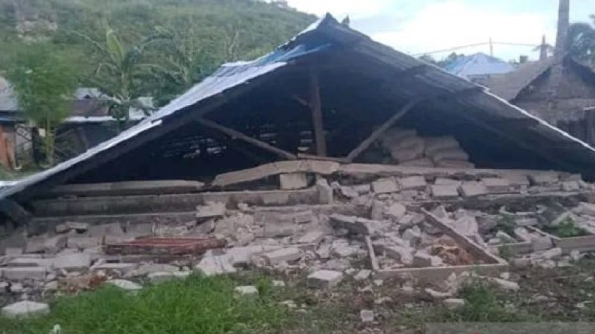


JAKARTA - The National Disaster Management Agency (BNPB) reported that 92 houses of residents of Tanimbar Islands Regency, Maluku, suffered damage after a magnitude 7.5 earthquake on Tuesday morning.
"As many as 92 houses of residents of Tanimbar Islands Regency, Maluku Province, were damaged when a magnitude (M)7.5 earthquake occurred on Tuesday morning at 02.47 WIT. Eight of them were severely damaged," said the acting Head of the BNPB Disaster Data, Information and Communication Center Abdul Muhari in a written statement in Jakarta, quoted from Antara, Tuesday, January 10.
Abdul said the latest data as of Tuesday at 11.00 WIB, the Maluku Province Regional Disaster Management Agency (BPBD) said that 80 houses were slightly damaged and four units were moderately damaged.
In addition to the residence, identification of damage to public facilities occurred at the regent's office and the Mandriank field stands in Sifnana Village, South Tanimbar District.
Previously, BNPB had informed that two educational facilities were damaged on the school fence, namely SMA Negeri 1 and SMP Kristen Saumlaki.
Damage is not only in the Tanimbar Islands Regency, but the BNPB Pusdalops received reports of impact in Southwest Maluku Regency. A total of 9 houses were severely damaged, while 23 others were lightly damaged. In addition, 2 educational facilities were severely damaged, said Abdul.
"Most of the damage in Southwest Maluku Regency is in Watuwei and Letmasa villages, Dawelor Dawera District," said Abdul.
Until now there have been no reports of casualties or the number of residents who fled after the earthquake. The local BPBD is still collecting data at the affected locations. Meanwhile, 1 resident in Romnus Hamlet, Wuarlabobar District, South Tanimbar District, was injured.
Responding to the M7.5 earthquake, the Maluku Province BPBD has held a coordination meeting to support emergency handling. Provincial BPBD Pusdalops personnel were deployed to assist data and information management. Logistical assistance from the provincial government in the form of rice, mats, blankets, family kits, rolled tents, kids wares and medicines.
The M7.5 earthquake was centered 136 km northwest of the Tanimbar Islands with a depth of 130 km. Some time later, aftershocks occurred with a magnitude (M) of 5.5.5, to be precise at 01.10 WIB or 03.10 local time. The epicenter of the earthquake was 197 km northwest of the Tanimbar Islands with a depth of 128 km. The epicenter was at sea and had no potential for a tsunami.
The Meteorology, Climatology and Geophysics Agency released the intensity of the earthquake strength measured at the MMI scale or Modified Mercalli Intensity, Saumlaki V MMI, Dobo and Tiakur IV MMI, Sorong, Kaimana, Alor, Waingapu, Waijelu, and Lembata III &nash; IV MMI, Merauke, Nabire, Tanah Merah, Wamena, Bakunase, Bakuhua, Rote, Sabu, Ende, South Amarasi, da Kupang City II &nash; III MMI, Ambon and Piru, II MMI.
Referring to the Signaled Earthquake Catalog reference and Disastering 1821 – 2018, Saumlaki residents experienced earthquake shocks with magnitudes above M7.0, including in 1920, 1995, 2006 and 2009. The record of the large earthquake that year was measured by the intensity of the earthquake between IV – VI MMI.
The English, Chinese, Japanese, Arabic, and French versions are automatically generated by the AI. So there may still be inaccuracies in translating, please always see Indonesian as our main language. (system supported by DigitalSiber.id)
Add VOI as a Preferred Source
Follow VOI news updates across Google.
+
Most Popular Tags
#Prabowo Subianto #donald trump #2026 World Cup #Febrie Adriansyah #8791Popular


24 Juli 2026, 06:07


